Average Rating:

|
| By:
Brian and Sylvia
|
Rating:  |
Date of Hike: Friday, October 25, 2019 |
| Fantastic Hike, very much lived up to billing Surpassed only by Old Rag on the list of Virginia hikes...definitely an icon. Fall colors very much still in peak on the last weekend in October. We did the loop counter clockwise, unlike most, and found this route to be quite viable. We had no significant issues going up the Mau-Har trail. But either way you do this, be prepared for the fact that there are MAJOR ascents and descents on both days of the hike. Situational notes: The ground bees past Harper's Creek appear to be gone or at least dormant, there is now reliable water at Harper's Creek, but Maupin Field Shelter appears to be dry (and overrun with Boy Scouts.)
|
|
| By:
Señor
|
Rating: |
Date of Hike: Friday, October 4, 2019 |
All around a gorgeous loop: beautiful views all the way in from Reeds to Three Ridges and on down the AT until the junction with the Mau Har. Ample campsites along the way, especially on the AT, though the biggest trade-off there is water: your only water spot coming down is behind the Maupin shelter 1.6 miles in from Reeds, which itself was a trickle (though just enough of an ebb to fill and treat). Otherwise you'll have to wait until the next shelter or the Mau Har, where Campbell creek is flowing with lots of water, including bathing pools. Amazing ecosystem diversity throughout, from the high fern plains on the ridges to the mossy forests with huge trees along the Mau Har. Easy to see why it's so popular only downside is just how many other people were also on a two night loop, thus making competition for campsites inevitable. This is especially true for the Campbell creek spot: lots of folks end up camping here right on top of each other in a relatively tight area, so if you're looking for solitude, it can be a challenge. If you're headed up the Mau Har for your second night, there's a small spot tucked away near the pools below the main area at Cambell, or if you head another mile upstream, another larger site.
And speaking of crowds, PSA: IF YOU'RE GOING TO CRAP IN THE WOODS, DO IT RIGHT FFS. Walking 10 feet away from your campsite literally in a creek bed to what seems like a dry area and barely covering it with a tiny rock and some leaves aint it. There were multiple of these all along Campbell creek, including right above one of the pools near the waterfall (apparently the concepts of rain and gravity are difficult to conceptualize for some folks).
|
|
| By:
Emily
|
Rating:  |
Date of Hike: Wednesday, September 25, 2019 |
Nice easy overnight backpacking trip or a substantial day hike. It's a highlight for its proximity from Rockfish Gap. Easy to get to, easy to hike, easy to follow, and nicely rewarding. It's not flat, but the climbs and descents aren't that hard either. On the Mar-Har section there is plenty of water and a nice swimming hole. It's got some really pretty campsites, but in my experience they can get overrun on the weekends. I definitely recommend using this trail as a mid-week option, especially in the fall.
----- Here are some important tips for Sept/Oct 2019:
POISON IVY: Know this leaf before you go because it is very abundant and close to the trail. Be careful. ----
LOW WATER LOW WATER LOW WATER: If you're planning on camping at Harper's Creek shelter (really beautiful spot with a shelter or ground camping halfway through the loop) follow these instructions so that you don't have to dry camp:
The closest water to Harper's Creek (mi. 7) right now (Sept 2019) is accessible by continuing to hike down the AT past the shelter until the stream crossing - maybe 1/4 mile tops. At the stream crossing follow the dry bed a couple of hundred feet down until you see a small pool of water about 10ft across. Lower yourself down to the mouth of the pool and underneath the stacked boulders you will find a small stream of flowing water that is slow but sufficient enough to collect for filtering or cooking. I don't recommend collecting from the pool itself.
From there you can return to the campsite at Harper's Creek or continue the hike. The next available water for filtering is 2.5 miles later on the loop off of the Mar-Har trail once the trail hits the much more plentiful stream.
|
|
| By:
Jim Nichols
|
Rating:  |
Date of Hike: Saturday, August 24, 2019 |
Hike the Mau Har Trail today as a follow up to completing the Three Ridges. Last weekend I did the Hike fro Rt56 to top of Three Ridges. This time I started at Reeds Gap and went counter clockwise along the Mau Har to the intersection with the AT up on Three Ridges and then back.
The day was cool, and perfect for hiking. Lots of people out. Once I was on the Mau Har past the camp area there was plenty of tough up/down along the creek. Seemed more down than up which made sense since the path was following the creek. Eventually the path started to curve away from the creek and climb to wards the intersection with the AT. Took a sandwich break at the trail intersection.
On the return back down the Mau Har Trail I made a 30 minute stop at the waterfall to take some pics and chomp down trail mix. This portion of the whole Three Ridges loop was a little tougher than the main AT portion that I hiked the previous week. Thank goodness for the cool weather.
Overall, about 10 miles and 4.5 hours. Then off to a watering hole and some dinner along Rt 151.
|
|
| By:
Jim Nichols
|
Rating: |
Date of Hike: Sunday, August 11, 2019 |
My wife and I started at the Alternate trailhead off Rt56. and hiked up to the top of three ridges then back down. We each carried more than day packs since we are prepping for some Peru hiking in Sept. Obviously we can't simulate elevation but we needed to build up 8 - 10 hour treks with elevation and single track. This was just what we needed. Since we haven't the hike before we opted for an "out and back" with a time limit.
The day was warm, we started at noon and finished around 8pm after about 12 total miles. VG up/down, some beautiful views with not a lot of traffic on the trail.
Next time we'll include the Mau Har trail.
|
|
| By:
Jane
|
Rating: |
Date of Hike: Friday, August 2, 2019 |
| Great hike for a WORKOUT! Definitely harder to do in one day than say, Old Rag. I understand why people split it up. My boyfriend and I are in good shape and it took us around 7 hours to do the full loop with a couple stops for lunch and snacks/water. The view at the first ridge was wonderful, but after all three, the loop back is quite strenuous. Lots of steep inclines the whole way. But many beautiful waterfalls and little watering holes, and pretty much the entire thing is in the shade. By the end you feel really accomplished! Definitely not your casual stroll, but it was incredible! Worth the trip for sure!
|
|
| By:
Jake
|
Rating: |
Date of Hike: Saturday, July 27, 2019 |
| Hikers beware that the water sources are dry along the AT so pack accordingly if you plan to do the full loop. The Mau-Har trail is the best source for moving water as of 7/27. We started our loop at RT. 56 Trail head and hiked counter clockwise. There is a small trickle at the Harper's Creek crossing but don't expect anything else in terms of fresh water until you start heading back SW on Mau-Har.
|
|
| By:
C Hemenway
|
Rating: |
Date of Hike: Friday, July 5, 2019 |
Terrific hike for hardy souls. The HikingUpward map and description are spot-on. Read and memorize them! Learn who The Appalachian Ambassador of the Blue Ridge is so you recognize him when he hooks up with you.
_____This is NOT easy! But it is truly worthwhile. Beautiful, lush, varied, easy campsites, and delivering earned bragging rights. The key is having enough WATER and TICK REPELLANT.
_____Take the route seriously, wear good boots that support your ankles, use poles (highly recommended), use plenty of Picardin everywhere, take a water filter/bags (!), choose clothes for brutally hot days with very chilly nights (this IS the mountains), pack a good first aid kit and hand sanitizer, take a laminated map (we each took the above map and description, double-sided) and a compass/ball-less whistle, and, most important, make sure you carry enough water and nutrition! We each had a 2L camel-back of water, and a bottle with another 20oz. And lots of GORP, honey Stinger packets, and salt/Nuun tabs, along with food.
_____PLAN on 1 mile per hour, especially if you're carrying 25 pounds (at 5'2" and 125 lbs myself), and want to keep your knees buckled. There are many potentially treacherous rockfall scrambles (up and down, worse when wet), and scree (worse when dry). Down is MUCH HARDER on your body than up!! Work and hope for better time than that, of course, but PLAN on this rate to be sure of enough water, calories, and, if you need it, moleskin!
_____Four of us (me, my daughter, my nephew, and my blonde-blue-eyed border collie mix) started at Reed's gap around 3:30pm on a very hot and steamy Friday in July, going clockwise. I recommend this route because there is NO WATER for the 7 (or 4.5, depending) miles on the east side of this hike until you get to Harper's Creek, and the rockfall scrambles and switchbacks are SERIOUS. This is not the route to return on! Pack water in. You can replenish close to the start (1.6 miles in) at Maupan Field Shelter where there's a spring (100 yards off the AT). Don't know how dependable the spring is, but it was running well this week. (It also has an outhouse, but, well, it's the wilderness, after all...)
_____There was NO WATER for another hard 4.5 miles to Harpers Creek. If you're cooking between "here and there," as we were, that's more water needed. But then there was plenty, fresh and delicious, all the way home on Day 2.
_____IN SHORT: From Reed's gap parking lot, we hiked South on the AT for that 1.6 miles to where the Mau-Har Trail (the return route) joins it at the northern end. We hiked another mile before pitching camp. Left around 8:30 am on Day 2 after a raw breakfast, summited, got to Harpers Creek Shelter and water refills at about 11:30am, cooked brunch, hit the Mau-Har at about 12:30pm, and arrived back at the parking lot at around 6:30pm, with stops along the way.
_____SHORT STORY LONG: At mile 1.6 on Day 1, where the Mau-Har joins the AT, we met up with Floyd, a really friendly, if smelly, guy, who traveled with us for the next 10 miles, spending the night with us between Bee Mountain and the summit.
_____He gave us a story to tell! And warmed our hearts.
_____
_____When we met him, we thought he was lost and called the number on his tag (he was well-tagged and had a flea collar on), and his owner said Floyd is known as the Appalachian Trail Ambassador of the Blue Ridge and knew his way home, which was nearby. I asked if we should just leave him be and was told yes. But Floyd had other ideas. HE wouldnt leave US and since he and our female pooch got along, we just let him tag along. He seemed pretty buff, despite a nasty sore on his rear end a big energetic white pit bull mix with a dark patch on his forehead. And VERY friendly!
_____We hiked over Bee Mountain, maybe another mile, but not as far as the second knoll and summit because it was getting late and storms were brewing -- lightning (hard to tell if it was heat lightning at that point) and thunder nearby, generally from the southwest and passing to the east. Fog rolling in. We found a great camping spot for two tents at a clearing with a fire pit, right off the trail.
_____We were concerned about water since we knew we wouldnt get to a stream until late the next morning. ALL of us needed more water than we expected, including the dogs, and were in danger of dehydration if we didn't ration. Though we'd packed only enough for ourselves and our pooch, we spared what we could for our guest.
_____We then learned a few hard LESSONS: Plan on having to share water and comfort with others in need!
_____We had some pasta, fed the dogs, and let them clean our dishes, then got our food/smells bag up a tree and away from bears. I made a shelter for Floyd because we werent gonna let him in our tents and it kept threatening rain. At about 8:30pm, we turned in. But Floyd had other ideas -- he would not settle down and kept grunting around our tents, trying to claw his way in.
_____We knew he wanted companionship and water. We took turns going out to scritch him a little and say soothing things. I tried tying him up, first near by shelter, which he broke from and tore down, then to a tree near some ferns he could sleep in, then to a makeshift dog run, but no rope we had would hold. Meantime, heat lightning and thunder periodically boomed by. Our dog, who was sleeping with my daughter, would growl a warning when he came near their tent, which kept him from trying to tear that one down.
_____But he kept huffing and circling ours for the next few hours, settling periodically just enough for my nephew and me to drop off to sleep before he started up again.
_____Finally, at about 2 AM, I prepared to go out and sleep with him if I had to. First I checked my water supply and figured I could share another cup. That seemed to do the trick and he fell asleep outside our tent opening, pressed up against our feet. At about 5am, he'd had enough of alone, ripped a hole in our tent screen, and climbed right in. We had to use all our might to shove him out and close the tent fully up for the rest of the night. (Anybody have tips for replacing a tent screen?)
_____All of us felt simultaneously sorry for him and upset at our interrupted sleep and at his owners. We decided a bear visit would have been better: It would have just grabbed the food and skedaddled. Chalk our mood up to sleep-deprivation grumpiness. But Floyd was so friendly and so clearly needed to be with people that he won our hearts! <3
_____He stayed with us most of the next day, both dogs absorbing as much water as their bodies could take the instant they reached Harpers Creek, till somewhere way up along Campbell Creek he took off, apparently knowing he was near home. Hasta la vista, Snuffleupagus Floyd!
_____My nephew texted his owners once we got back and found out that Floyd is 10+ years old (they're not sure) and that the only way they could prevent him from wandering was to chain him up which didnt seem right to them. They assured us theyd take him to the vet on Monday for his open sores. They seemed very kind. We mentioned nothing about the tent.
_____It turns out Floyd is well known for traveling a good distance with hikers and that he is TERRIFIED of thunder!!! Poor boy!
_____All of us felt extra bad then because we knew he had just wanted to be comforted during last nights scary noises! We had done our best though, and gave him yummy leftovers and good companionship.
____
_____It never did rain, though all of Day 2 we were getting ready for it on and off as dark thunderous clouds swept overhead. I'm extra glad it didn't because the rockfalls would have been absolutely ankle-breaking with water cascading over them. Just damp or dry, they were challenging and I was really grateful for all those boot camps that strengthened my core and joints, and for high tech walking poles that provided stability. Could have used workout gloves for those poles, though.
_____Definitely take the time to stop at overlooks and to take in the life-affirming lushness of it all. What's the point, otherwise? There aren't that many overlooks in any case.
_____Chimney rock is easily missed since it isn't exactly at an overlook -- but it sure as heck does look just like its namesake, so watch for that. If for no other reason than it anchors you on the map. The most difficult part of the trek was from the next overlook down to Harper's Creek Shelter, imho, mainly because the scree and rocks were hard going, I was a bit wobbly from too little to eat at that point, and now I really wanted enough water to gulp it down indiscriminately. Lesson: Keep those calories going in!
_____You can hear the water well before seeing it and no, it is not wind in the trees! You're not imagining the oasis. But my goddesses it takes FOR-EVER to get down down down down down to that fount! Have faith.
_____You're finally at "signs" of civilization where the AT does a U-turn just before the shelter you can imagine you're at the Mau-Har going to the right in your delerium, but you're not. You're at that shelter -- and the creek! Nothing looked sweeter than to spot "the kids" filling up water bags ahead of me there, let me tell you!
_____
_____There are amazing god-people who can leave "on time" (i.e., early early) from Northern Virginia and get to this shelter 2.5 hours away on Day 1, in time to set up camp and relax with their wineskins and "joints" all in order. We are not those people. At least *I* am not those people, as the looks from "the kids" let me know the morning of Day 1. "The looks" that didn't appreciate how I had actually HELPED BUILD THE BIG BLUE and MAINTAIN THE AT back in the day!!! Snort.
_____I am not "those people" after Momming, and "loaning" outdoorsy things to my three kids for 20 years, and now wondering where they walked off to when I'm ready to befriend them myself again. Oh no! Not after remembering that my own (then primo) Kelty bit the dust years ago and I this week have to figure out the new rigging of the backpack I scrounged out of the attic that I had got one of the boys when they were wee Scouts and just about my size! Not after hunting and pecking for first aid supplies as someone who DOES DISASTER PLANNING for a living!!
_____But I AM the Mom who em braces with all her heart the invitation a week before from her daughter for our first non-full-family actual backpacking trip together. I'm the one who says "YES" and will figure out HOW later. :-)
_____AND I AM the Mom who has the perfect GORP recipe, knows that you can't have enough heel blister packs or waterproof bags, and has enough experience with bears, snakes, and bugs to know how to calm a few "kids'" fears (ahem) with tree-bag spotting, Black-vs-Grizzly-bear trivia, before-stepping-over-logs copperhead hellos, Picardin, and tick removal skills.
_____And I'm a Mom who is an early-adopter of tech, but can't afford what the kids can, so they get the cool stuff. I know what the cool stuff IS, kids! And I used to have it before I had you, who it turns out ARE the coolest of the cool "stuff," and who re-defined "cool." And (hey!) from whom I can can now borrow!
_____
_____Having said all that, DO NOT STINT ON A "COOL" aka "HIGH TECH" WATER FILTER!
_____The water beginning at Harper's Creek is really good and comes from uncontaminated springs, and gets even better along the Mau-Har. But fill up at Harper's because it's a long while with lots of uphill and over-the-ridge before getting to Campbell's Creek.
_____The rise up to the Maupin Shelter is easy to tell because it's where the trail definitely leaves the creek, whose tributaries you cross over several times. Rest there for a bit and check your water because the last 1.6 miles back are deceptive.
_____The uphill is just regular uphill mostly, but the downhill takes work. You have the psychological component of knowing you're "near" the end but it seems much further than you "remembered." You forget that the climb up this was a no-brainer, with all your anticipative spirits taking the lead. You're tired and the risk of injury is now highest. And there are rockfall trails to navigate. Take care.
_____Nevertheless, the ridgeline is a welcome distraction, as is the gorgeous vegetation, and when you get to the double-track trail, you know you've just about done it! Hurray!!!
_____
_____We came back with more than a few stories: Tick count was 30+ among the four or us, most of them dead and from the dog, none of them engorged.
_____DO A THROUGH, CM-BY-CM TICK CHECK!!! All but one tick was large (ca. 3-5cms) one was smaller than a pinhead. We found many of them the next day in the sheet the dog slept on (deliberately, so ticks wouldn't nestle in a blanket), thankfully dead, having probably been tangled in hair or lying close to skin under it. Since they were not engorged, I had had real trouble "feeling" them. I did another nose-to-tail-to-nose check. She-the-dog probably thought I was the BEST MOM EVER, giving her all this loving. Heh.
_____I discovered that A) Picardin works, but spray it on all your clothes, especially the openings, and on the dog, especially the tail and joints and warm/moist spots, B ) The dog's thick border collie coat is a great deterrent and net, and C) her oral tick protection (NexGuard) actually kills them right away when they get near her skin.
_____LESSON: Take the tick-removers with us next time (I have TickTwister -- easy and works every time!). We are all agreed ticks have no business existing they contribute nothing to the ecosystem but gross us out and spread disease. Eh.
_____As for solitude vs. crowds, this was billed as a popular loop but we met very few people, expecting more for a long weekend. We came across mostly AT through-hikers and some hardy souls doing the 14-mile loop in one day, including a wiry woman I guessed was in her 70s who probably finished the whole thing in 8 hours. Inspiration! And a man had heard-tell of the Blue Ridge Ambassador (Floyd) and was glad to meet him! So I guess we hiked with a legend, after all.
_____
_____Walking along ridges with vistas on each side, mossy nooks, lush fern meadows, a well-maintained trail, fresh clean water, and family friendship.... Never felt so good ....
_____Chewy pasta, instant oatmeal and coffee (yes, with real cream, I have my standards), hard boiled eggs, GORP, salami and cheese, apricot/PB&J on pita, and apples .... never tasted so good...
_____A big old VW van to take us home to a shower and a Women's Futbol World Championship from the sofa ...
_____Who could ask for more??
_____TOP HIKE!
_____
_____(I didn't rate this five stars because it couldn't climb to "one of my favorites" YET -- a hard task for any trek since I've backpacked all over the world. But it is WELL-worth the trip from NoVa, the side-eyes from kids during prep, and getting your old gear out, tested, cleaned up, and ready for action! Smiles all around.)
|
|
| By:
|
Rating: |
Date of Hike: Saturday, May 25, 2019 |
I've been hiking Three Ridges for over 25 years, since way before it was designated federal wilderness in 2000. It remains my go-to fitness hike which I complete several times a year because it is close to my home and offers a tough workout. Unfortunately, it is reaching Old Rag-level overcrowded levels on Spring and Summer weekends, with parking lots on both ends full beyond capacity by 8AM on a Spring Saturday. If you are looking for a true "wilderness" experience, this is not the place, due to large numbers of backpackers and day hikers on the loop. I've seen over 50 tents camping at Maupin Field! Several loop hikes in Shenandoah National Park offer similar challenge and much more isolation than Three Ridges.
It is also important to know that the Mau-Har Trail is an exceedingly difficult trail to complete, especially with an overnight pack. It is steep in parts and very rocky in others. It is not a good shortcut between Maupin Field and Harper's Creek Shelters. Stay on the AT instead.
|
|
| By:
Grant Wiley
|
Rating: |
Date of Hike: Saturday, May 25, 2019 |
Second time hiking this trail with an overnight backpacking trip in mind. The first time I ended up hiking the entire loop in one day while this past weekend I hiked the trail stopping at Harpers Creek Shelter and finishing the second half the second day. With this being said, the guide is somewhat misleading with the first day being 7.3 miles and the second being 7.1 miles. If you stop at Harpers Creek Shelter on night one it ends up being around 8 miles and day two is closer to 5 miles. The second day has a huge climb out of the waterfall area and therefore it is still tricky especially if you are exhausted from the day before.
Overall, it is a great hike although it was extremely crowded on Memorial Day weekend therefore I would recommend getting out early to secure a camping spot. If there are no spots at Harpers Creek Shelter you can go downhill from the campsite and find many smaller campsites that have been made over the years.
This is a tough hike so make sure you are ready for some above average hills for this area.
|
|
| By:
Gina M.
|
Rating: |
Date of Hike: Saturday, April 27, 2019 |
| Drove down from DC early Saturday morning and arrived at the trailhead around 10am. My boyfriend and I backpacked clockwise, making it to Harper's Creek at around 3pm. The creek was a great location with at least 15 camp sites and easy access to water. We had minimal backpacking experience before this trip, though we otherwise hike frequently and stay fit. This was a challenging loop, however the views of the ridges and waterfalls, paired with the lovely camp spot made this trip worth it. The weather was perfect this time of year. We would absolutely hike this again, though I may prep more beforehand to avoid some of the post-hike fatigue. Stopped by Blue Mountain Brewery on the way out for a few well deserved beers and fries.
|
|
| By:
|
Rating: |
Date of Hike: Saturday, April 6, 2019 |
| This is a great two-day backpacking trip. Early April is the perfect time for this hike since the weather is usually mild and the leaves are not out yet so the views are terrific. We started at Reeds Gap and went across Three Ridges bypassing the camping at Harpers Creek. Found a couple of spots off the Mau-Har Trail on Campbell Creek. Mar-Har is very beautiful this time of year with plenty of flow in the creek. Highly recommended!
if you're interested in seeing a video, you can view it here:https://youtu.be/bvFP5Uq1Uy8
|
|
| By:
|
Rating: |
Date of Hike: Thursday, December 6, 2018 |
| Completed this hike counterclockwise (Mau-Har to AT) overnight. Typically this hike is well trafficked, but I didn't see a soul until the second day mid-way through the AT portion. While I greatly enjoyed it, I wouldn't recommend the Mau-Har trail right now. Especially not for beginners or those with limited navigational skills. There was easily 2-4 inches of snow on the trail which made it very difficult to navigate and stay on course. At times the numerous blowdowns meant you had to detour a steep 10-20 yards down/up the mountain and then back up to get back to the trail. The AT portion was much better maintained (still had a few blowdowns covering the trail) and the views were spectacular with the snowcapped mountains in the distance. As others have pointed out, there is very little of this trail that is flat and you are almost always either going up or downhill. Plenty of water access on the Mau-Har Trail, but virtually none on the AT side so bring enough to get you through that portion without resupply. I camped overnight at the Harpers Creek shelter which was well maintained and only about 20 yards from the creek. Overall this hike has some of the best mountain views on the east coast and I would highly recommend it for anyone fit enough to complete it. As always, give the Ranger Station a call before going to get a read on the trail conditions.
|
|
| By:
David
|
Rating: |
Date of Hike: Saturday, November 3, 2018 |
I must say, every time this hike impresses me more. This is the third time doing the loop, but the first in the fall colors! And wow, have I been missing out!!
The only thing of note for future hikers is the amount of people on trail. In the past, having done it in the dead of summer and mid-spring, I was able to get a comfortable spot at the main camp site on the Mau Hau trail. This time though, arriving to the site at 5pm, all main area's were taken and we had a group of 4 tents! Luckily, for those not aware, you can cross the creek and make do with some decent spots along an old, unused trail. There is a fire set up and you'll have the creek in between you and the other campers to drown out the noise.
The fall colors were amazing, the weather perfect, and really, just a great hiking experience. In our group were two newbies who'd never backpacked before so this is a solid experience for those to introduce them to overnight hiking.
Devils backbone brewery afterwards rounded out a solid weekend!
|
|
| By:
|
Rating: |
Date of Hike: Saturday, October 20, 2018 |
Hiked this at the beginning of the fall, the colors weren't totally changed, but it was still beautiful. I would recommend taking in the views when you can because it is a strenuous trip otherwise.
I hiked to the Maupin Field Shelter the first day, it was an easy stroll and I arrived with the sun coming down. The next day I ended up finishing the entire hike and leaving at around 3:00 PM. I don't recommend this unless you are an experienced hiker with endurance especially with hills. The views make up for the hard hills, and it isn't an overly tiring set of elevation.
Would certainly recommend for a two day hike.
|
|
| By:
Matthew Growney
|
Rating: |
Date of Hike: Saturday, October 20, 2018 |
| I've done this hike twice now first on 6/23/18 - 6/24/18 Clockwise and again on 10/20/18 - 10/21/18 counterclockwise. As best as I can tell the millage is recorded incorrectly here and elsewhere. I've seen three claims stating GPS tracked the mileage between 16.3-16.5 miles. I don't think I would be able to complete this as a day hike, at least not with the 3 hour car ride to and from the trailhead. Both times I camped at Harpers Creek, both times it was very crowded. The trailhead parking lot at Reid's Gap has also been crowded both times where I was barely able to squeeze my little civic into the last available spot. PLEASE don't leave large spaces between vehicles, others are likely to come behind you and the extra few feet adds up. The hike is very challenging though I think I preferred counter clockwise simply due to my knee killing me on the descents heading SB on the AT the first go around. The best views aren't at the summits but along the ridge walks in between so be sure to enjoy them. There is signage for a Waterfall near the campsites at Campbell creek but for the life of me I could not find it. After the Switchback heading SB on the AT there is a boulder field where there don't seem to be any white blazes on the AT but there are a couple heading NB as I noticed this last time. There are a couple of water sources along the ridges, but they are not reliable so I've been told. Finally the Mau-Har Trail is pretty technical along with parts of the AT coming down to or up from Harpers Creek opposite of the Mau-Har Trail. Trekking Poles are your friend -)
|
|
| By:
|
Rating: |
Date of Hike: Saturday, May 12, 2018 |
| My sister and I did this hike as an overnight. We hiked from Reids Gap, camped at Harpers Creek and returned via Mau Har Trail. We started on the trail about 11am and got to Harpers Creek Shelter around 6:45pm. Obviously we took several breaks and arent the speediest of hikers, it was also over 90 degrees. This was my first time hiking a "5" rated difficult trail and it proved to be pretty hard but rewarding. Most of the inclines are very steep- with that being said, I couldn't imagine hiking up to the overlook from Harpers Creek, but thats just me :) It was hotter than normal on the first day, about 90, and required more water and breaks than normal. Our packs were pretty heavy because we hauled in our own water.
We weren't expected the steep .8 incline at the beginning of the trail but making it to the overlook after a few more inclines was a perfect place for a snack and time to relax. I ultimately needed some shade though since it was so hot. Hiking down to Harpers Creek was a steep steady downhill with lots of rocks- my calves will be sore for days. Arriving at Harpers Creek was blissful- flowing creek and plenty of camp sites. The firepits are built well and it was amazing to fall asleep listening to the creek. We took a dip the next morning and set off for the waterfalls at Campbell Creek. This was by far the most rewarding part of the trip in my opinion. There were a few steep inclines to get to the falls, but a perfect spot to take another dip and eat some lunch. There is an abundance of greenery and shade and more than one spot along the trail for swimming holes. Hiking along Campbell Creek was strenuous but I enjoyed the uphill rock scrambling much better than simply walking uphill. I had to stop multiple times (my sister was getting annoyed) to take pictures and videos of all the waterfalls and wish we had more time to swim. The cold water felt amazing! There were still some strenuous parts after this and a long break at the Maupin shelter was much needed before the last little haul back to Reids Gap. The downhill definitely took a toll on my calves but it was worth it. There were millipedes everywhere and they seemed to want to hang out on the exact spot of a rock or tree that you need to grab a hold of so watch out for accidentally knocking them off :) We saw a baby snake, butterflies, toads, and lots of little critters. Not sure if I'd do the whole thing again in its entirety, but I would definitely visit the waterfalls again.
|
|
| By:
|
Rating: |
Date of Hike: Saturday, April 28, 2018 |
| Did this as a solo 2 night/2.5(?) day backpacking loop. Got to the parking area at Reid's Gap around 8pm on Friday evening (like Banjo below, I was coming from DC), and got one of the last spots in the main lot. It had been a long day so I just planned on setting up camp at one of the first sites I found. Hiked up about half a mile and found a small site off to the left of the trail perfect for a one man tent. Doesn't look like it gets used that often, as there wasn't a totally clear trail to it and the fire circle was unusable without a bit of TLC, but the site met my needs. There is a larger site, about 100 yards to the South, but that was already occupied by about 8 loud drunk dudes, which made for a bit of an annoying night. Luckily there was a steady bit of wind up on the ridge so it wasn't totally silent. It was a full moon so even without a fire I still had enough light to not immediately get in the tent, but there are no real views from here. The partiers went to sleep around 10, as did I.
Woke up around 6am Saturday hoping to get some sort of view of the sunrise, and caught a decent one through the trees. Packed up camp by 7:30am and headed south on the AT, passing a few nice campsites on either side of the trail. Some very cool rock formations right on the trail to climb around if you feel like killing some time in the morning. Got down to the Maupin Field Shelter not long after, and with the weather for the weekend looking incredible, it was tent city in the entire area, with the shelter being full as well. Topped off my water from the creek behind the shelter (was flowing very nicely from the rain during the week), and talked to a few hikers mingling about. I decided I wanted waterfalls my first day and the view from the top of Three Ridges on the last day. I'll summarize my choice at the end of the review, but from this point I set off south on the Mau Har Trail. So if you plan on hiking this clockwise, read my review backwards :) Absolutely loved the hike next to Campbell Creek. Trail was in great shape and the terrain was interesting. Because of the said rain, the creek was flowing nicely, but not too hard to cross. A few downed trees, and I was leapfrogging with some of the Old Dominion Trail maintenance guys who were scouting for doing trail repair this upcoming weekend, very cool chatting with them. As a photographer I had my gear with me and stopped a ton to take photos of the falls, very pretty with the full water flow. Got down to the trail split that goes down to the waterfall (can confirm, there is a sign there on your right.) I was questioning time, so I decided to skip the yellow blazed waterfall trail, and push on, as I knew I was going to stop for more photos along the way. Passed maybe three other solo hikers, but overall had the trail to myself.
I got to the intersection of the Mau Har Trail and the AT at 12:30, and had a huge decision to make. Either hike to the Harpers Creek shelter and set up camp way early, or add some mileage and head down the AT south to the Tye River. Highly recommend this if you have extra time. The suspension bridge is very cool, and a great spot for lunch. I met a few thru hikers as well, that had just come down from the Priest, and chatted with them for a bit about their current trip, very cool. The NOBO thru hikers are starting to funnel in, so if you go I highly recommend chatting with them if they are up for it. Departed Tye River and headed back up the AT headed to the Harpers Creek shelter, and was there by 4pm. Still a bit early for my taste, but I was able to snag a phenomenal site down by the creek. There are some really great sites near the creekside, I recommend getting there earlier than later if possible to get a good one. If not, there are a ton of sites (easily a dozen, probably more) in the wooded area on the other side of the creek. Had some dinner, started a fire, talked to a few other hikers there for the night. This is a really great spot with the creek flowing, would stay here anytime I do this hike again. Resupply for water here, if you are doing this counter-clockwise, because you have very, very few options until you get back to the Maupin Shelter.
Knowing I still had quite a bit of mileage for Sunday (and some crazy elevation change), I set out around 7:30am, and the going was tough for this portion of the AT. There are a ton of downed trees (AT group said a bunch of it was from the wind storm in March), rock fields, and hearty ascents. Eventually you start rounding the mountain and get some good views across the valley of the Priest. I will note, this part of the trail is best done in the cooler months when there are no leaves, otherwise, green tunnel. Climbed around on Chimney Rock a bit, got some photos, and pressed on. There are some great views once you're up here, facing South and East. You eventually run into switchback city uphill, and this was fairly unrelenting to me, and I'd consider myself in really good shape. But once on the ridgeline, it is fantastic. Some really nice campsites, nice breeze, and some views through the trees. The view from the main overlook is phenomenal, great panorama possibilities for photos. I lingered here for quite awhile knowing what was coming, descending the AT. Prepare to take things very slowly, it is rocky, and very steep at times. And it seems to last forever. You get some reprieve on the ridgelines going down, but otherwise watch your footing. Got back to the Maupin shelter around 1pm (I took it very slow), grabbed a snack, and was back at my car at 2pm.
Overall I think I'd like to do this clockwise. The push coming North on the AT on the last day was rough, and you really have to conserve your water. Hopefully they get that section of the trail cleaned up soon, as with weather finally taking a turn for the better, you'll see more and more people out there. I think this is a fantastic hike, and would highly recommend to anyone trying to test their athleticism. But note, you will be sore :)
|
|
| By:
|
Rating: |
Date of Hike: Saturday, April 7, 2018 |
A wonderful and challenging hike, although the mileage is a bit deceptive--we needed to add on mileage to make a complete first day. Went here with my girlfriend despite the ominous forecast for this weekend. We arrived at 10pm on Friday night (we live in DC and couldn't get off work until 5pm). The entrance to the trail is well marked. Park in the parking lot and look to your left for a meadow with the AT marker. We hiked up a steep hill in the dark for a half mile before plopping down at the first campsite we saw, before the first official shelter. It was a windy night, but we managed to get some sleep on the ridge. Just be aware that if you camp here, it'll be windy.
Woke up at around 8am and we were on the AT by 9. We hiked to the first shelter (Maupin) and made some oatmeal and coffee and relaxed until 10 or so. Although this website suggests hiking the AT portion first (clockwise), we decided to go counter-clockwise and tackle the Mau Har trail first. We did this because it was overcast and we feared the views wouldn't be great. The Mau Har trail is not as difficult as we expected. It's beautiful hiking along the creek, and there's plenty of water if you need it. Even with a stop to take a look at the waterfall (be careful--the yellow blazed turn-off trail is a little hard to spot), we made it to the junction of the Mau Har and southern portion of the AT by 12:15. Keep in mind both my girlfriend and I are in our mid-20s and in decent, if not slightly above-average shape. We made the decision to tack on some extra mileage and do an out-and-back along the southbound AT (marked on the map with a dotted white line). We ate some lunch and descended about 1.5 miles to the beautiful Tye River, which has a very cool suspension bridge that makes for a good photo op and water resupply. We then hiked back up the trail back to the Mau Har/AT intersection, and hiked the .8 miles to the Harpers Creek Shelter.
We made it to the Harpers Creek Shelter by 3:30...a bit early, for our liking. Only say this because without the SOBO AT add-on, we would have arrived at around 1. Granted, there was freezing rain and if the weather was nicer we would have dipped in the beautiful pools along the Mau Har trail. We set up camp in the James Creek shelter and watched the freezing rain turn to snow from the comfort of the shelter. Four NOBO AT hikers arrived around 5:30 and regaled us with stories of their hike and talked for hours about lightweight backpacking. They all went to bed around 8pm, so we did too. One of them snored awfully loudly, which was considerably less enjoyable than falling asleep to the sound of the James Creek. The hikers headed out around 7 and we were up by 7:30. We made breakfast and a small fire with the twigs we stored under the James Creek shelter overnight. We were on the trail by 9:30. There are quite a few downed trees on the beginning section of the AT/Three Ridges hike, and the white AT blazes are faded. We turned back, thinking we'd erred in our directions...but it turns out this was the right way.
The Three Ridges hike is taxing--it's a steep ascent for 2+ miles to the second ridge, which offers stunning views of the valley in good weather. This section is harder than anything at Dolly Sods, for comparison sake. There's very little water, but based on other reviews we stocked up at James Creek in the morning. Both of us were awfully sore by the time we reached Bee Mountain, but the hike is manageable for anyone in decent shape. The footing is tricky while descending the second peak, especially with the ice and snow from the day before. Just be ready for a challenging second day if you hike counter-clockwise, which I'd recommend. We hit the NOBO AT/Mau Har trail intersection around noon, and made it back to the car around 1:15. As others suggested, we went to Devil's Backbone Brewery afterwards (a 10 minute drive) for some beer flights, and stopped by downtown Charlottesville on our way back to DC.
All in all, this was a fantastic hike. However, hiking counter-clockwise (and perhaps clockwise) at a decent pace will put you at James Creek shelter far earlier than you expect. I liked hiking down to Lye River and bouncing on the suspension bridge to tack on mileage, but be aware that the River is right next to a road. This takes you out of the "wilderness" mindset, but neither of us minded. We emerged from Three Ridges happy and sore, and full of good beer and food from Devil's Backbone and downtown Charlottesville.
|
|
| By:
Rob
|
Rating: |
Date of Hike: Saturday, March 17, 2018 |
My friends and I completed this hike on a blustery March day. There was plenty of snow and ice still on the trails from earlier in the week and it made the first few miles brutal. Overall, we averaged in the area of 1.9 miles per hour and completed the hike in right at 7 hours of walking with a 15 minute eating break thrown in.
When we arrived at 9am, there was still plenty of parking at the Reeds Gap lot (probably because not a lot of people thought it was a good idea with the conditions). We took off on the AT and soon reached the first large camping area with a trail map posted on the standard trail bulletin board looking stand. Unfortunately, the map had 3 different views with 2 of the views having different North indications and the largest having no legend or compass at all. We all had printed maps and directions from Hiking Upward so, no worries. Continuing on, we passed vista after vista and the lack of tree cover made it possible to see things that would likely be missed during the greener months.
My favorite part of the whole hike was arriving at Campbell Creek and hiking alongside it. There were rock scrambles, waterfalls and that whole section was amazing.
Walking back out, we came across the shelter that stands near the first campground we passed but there's no clear indicator which of the 700 paths through the campsites leads back to the AT. Apparently, most of them do because we just ended up picking one and following it with no problems.
Walking back to the car through the now slushy ice was a challenge in itself. Lots of balance was needed to not bust our butts getting and seeing the road was a heaven sent after hiking for that long. My Garmin had us at 13.56 miles in 7 hours and it was every bit as difficult as people say. I'd like to go back and do this one as an overnighter in the future, though.
|
|
| By:
|
Rating: |
Date of Hike: Friday, March 9, 2018 |
Three of us planned on hiking this loop as a 2-night trip. We planned to do the route counter-clockwise and save the ridge views for the second day or the third day on the hike out.
The trails were very well marked and we had no issues navigating. The Mau-Har trail was rocky and challenging. The AT on the way out was better maintained but also very difficult. This trail is very physically challenging if you end up doing it only as a 1-nighter as I'll explain.
So we parked at Reed's Gap, made our way to Maupin shelter and set off to the right on the Mau-Har trail. There were numerous creeks and water sources along the way. We stopped at Harper's Creek for lunch and to refill on water. Our plan was to hike up to the first ridge and find a spot up there to camp with a great view. We thought we would camp on the ridge, and then come back down to Harper's Creek for water the next day, or maybe find another source on the way up the ridge. We severely underestimated the difficulty of the ascent from Harper's Creek to the first ridge. By the time we found a decent spot to camp we were almost 3 miles from Harper's Creek and based on the terrain there was no way we were going back. We had gone almost 8.5 miles that day and were exhausted. With very limited water and no additional water sources on the ridge we decided to just say one night and hike out the next day. Three of us with only 0.5L of water to get back and 5+ miles ahead of us. Back on the AT the next morning on the way out we didnt find a water source until almost all the way back to Maupin shelter where one of the guys luckily spotted some ground water flowing out of the base of a giant tree.
The hike was challenging, and although it was rewarding we were disappointed that we had to cut it short. Long story short, if you are doing this hike counter-clockwise, take plenty of water and conserve it. There is plenty of water on the Mau-har side. And almost none on the AT side (based on our experience and time of year completing the hike - early March, high temps in mid-30s and lows near 20).
|
|
| By:
Tom
|
Rating: |
Date of Hike: Sunday, February 18, 2018 |
Six of us Hit the trail at 5am under headlamps. We did the route counter-clockwise from Reeds Gap. Managed to sneek by what appeared to be 3-4 hikers sleeping in the Maupin Shelter without waking them. MauHar was in decent shape considering the 2/17 ice storm. I wish I would have had my folding saw with me.... Watching the sun come up casting shadows on The Priest and neighboring peaks was unforgettable. If you haven't started a hike in the dark, I suggest you try. ...assuming you have the skill and know how.
Got to Harpers Creek shelter in a timely manner to find a field of tents. Apparently this was a prime weekend for scouts. I've never seen so many tents bunched together in the back country. So happy we didn't make this a 2 day trip with plans to camp here. Never less, I take enjoyment knowing there are still young men learning and enjoying the back country. Passing by some lads making eggs and bacon made us all a little envious of a hot meal. We ate a quick lunch creek side (@ 9am...) and headed up to the Three Ridges. This trail never fails to test your fitness. It's not for the unfit or weary footed hiker. You will trip, slip, and cuss at some point during these ascents and that's without ice. The icy spots only add to the adventure.
The western sides of the peaks were still untouched by the sun making for many icy rocks and logs. We managed just fine with a few slippery moments of laughter. The AT definitely needs some clean up on it. Numerous trees, big and small, have fallen this winter. Again, I wish I had my folding saw to help with the smaller stuff.
Overall, this remains one of the best backcountry challenges in the area. Be it a challenging 2 day or a vicious 1 day, the terrain is ever changing, the climbing is relentless, but the views are spectacular (make a point of going in the winter). I had a thought at one point in the day that people need to add this circuit to their New Years goals. Skip the local 10k trianing team.....instead, train for 13.5 miles of backcountry hiking on these wonderful resources we have in the Virginia Mountains.
|
|
| By:
|
Rating: |
Date of Hike: Saturday, January 13, 2018 |
I have done this hike several times before in every season and it's always a good hike. My friend and I started around 9:00 am with a strong wind and temperature in the mid 20's. We hiked to the Harper's Creek shelter and set up around 2:30. The previous rain made finding wood for a fire a bit of a challenge but knowing the temperature was dropping we were up for it. Harper's Creek was the highest I had ever seen it, we had to cross on a fallen tree.
It got down to about 10 degrees at night but the wind settled down. The past guests of the shelter left a lot of trash behind, we did our best to pack out what they left but it is going to take a couple of trips.
The next morning we headed out and met up with the Mau-Har trail. That trail is what gives this hike its difficulty rating. The freezing temperatures made scrambling up the rocks on the trail a little more exciting due to the ice. There was two more creek crossings that were a little high. If you have the balance you can make it over them on some narrow fallen trees, otherwise take off your boots and play it safe.
We only ran into three other backpackers, the temperature kept the weekend crowds away.
|
|
| By:
Chad DiMarzo
|
Rating: |
Date of Hike: Saturday, November 11, 2017 |
| If you like a challenge, awesome views and a leg burner, this hike is for you. Highly recommended! Oh and Devils Backbone Brewery is only 3 miles away for a victory Beer.
|
|
| By:
nort
|
Rating: |
Date of Hike: Friday, November 10, 2017 |
| Hiked this as a day hike with my son. This is a fantastic hike! It has it all: views, waterfalls, wildlife, everything. This time of year was great because the leaves were mostly off the trees at elevation, so there were decent views on the ridges and not just at the overlooks. It rained the day before we hiked and the streams were running--there was plenty of water everywhere. The cascades at Harpers Creek Shelter were beautiful, and the waterfalls on the Mau-Har were even better. The only downside to this one is that it is very popular and we saw a lot of people out there. Hiking out on Friday evening, there must have been 30-40 people camping out there around the two shelters despite the forecast low of 18 degrees. This is one of the best hikes in the mid-atlantic--don't miss it.
|
|
| By:
|
Rating: |
Date of Hike: Wednesday, October 4, 2017 |
With a twist... Hiked 10/3 through 10/6 - 3 night
I added an out and back to the Priest. You are already here, so why not...
Started at Reed's Gap, hiked to Harper's shelter via the AT, and settled in for an early night. The creek wasn't moving much, but there is water to drink. Also, the owls were incredible all night.
Left Harper's and went up to the Priest shelter. There is 1 creek bed along the ascent with plenty of water, so pack light when you leave Harper's and resupply about 1 mile south of rt 56.
On the ascent of the Priest you are going to ask yourself, "why did I do this..." but, the view at the 1/2 way point and the other at the 7/8 point will remind you why you did it. Oh, and the roughly 2 year bear cub near the creek will give you some enjoyment.
The Priest shelter water source is barley holding on, but still sufficient for a stay. There were lots of deer wandering around at night, and I found fresh bear poop in the morning. Not sure what time it came through, but sorry I missed it!
Heading back down the Priest is quick. Pack light, but restock on water at the same creek bed you hit on the ascent. This water will need to get you about 4 miles.
Cross 56 heading north, and then take the Mau-Har. About 1.5 miles in, stay at the campsite established where the "falls" sign is located. The stream will give you plenty of water, and the owls again will hoot all night.
Leave the camp and continue north on the Mau-Har back out to Reed's Gap.
This was a great "get away" hike. Pretty strenous, but fun. Tons of wildlife, and great sights.
|
|
| By:
|
Rating: |
Date of Hike: Saturday, September 23, 2017 |
This circuit is definitely for experienced hikers. My significant other and I went on a 2-day, 1-night backpacking trip this past hot Fall weekend (9/23 24/2017). We arrived at the trailhead at 11:35 AM on Saturday and the parking area was nearly full! We hiked the trails as shown on the maps. The 2 rating for Solitude is spot on, as we could not go more than 30 minutes without seeing anyone. Many people who passed us were hiking the trail as part of a very long day hike. After spending an hour at the vista overlook, we arrived at the Harpers Creek campsite by 6:00 and made sure our tents were up before nightfall set in.
We left the campsite by 10:45 AM and made it back to my car by 2:10 PM on Sunday.
We were confused about the directions through the Maupin Field Shelter, as it took us 15-minutes to understand what Continue straight past the shelter for 150 yards meant. In actuality, you want to bare right and take the second trail option (the trail that leads to more campsites, after the one that leads to the outhouse).
The biggest takeaways is that it really it is a strenuous hike, with some views (the best view being the first vista view [the first camera icon]). There are many more inclines or ascends throughout the AT and the Mau-Har Trail, that the description does not mention. There was very limited water at Harpers Creek campsite. You really are rolling the dice if you completely run out of water before getting to this shelter. Case in point, there was one couple that passed us early Sunday morning as they scrambled to find a water source at the Campbell Creek campsite, which was about 3.5 miles away!
I agree with CJP in regards to spending an overnight camping weekend elsewhere.
|
|
| By:
|
Rating: |
Date of Hike: Sunday, August 6, 2017 |
| Did this as a training hike for a trip out west. It's tough to find a circuit hike with 4000+ feet of climbing, but this one fit the bill! I carried my 30 pound pack, and it was definitely a tough day. The first uphill was fine with the reward of great views. I got a little nervous for a bit in the downhill because the trail was overgrown and I thought I had lost it, but eventually I saw another white blaze. The downhill was LONG and brutal, and I felt sympathy for those (trail runners and hikers with packs) coming up that side. By the time I got to the falls, I was too tired to enjoy them so I just kept plugging along. The part I was not expecting was coming up from the falls. Super steep, rock scrambling, slow moving for about a mile. It then flattens out a bit and you still have to climb, but it's much more forgiving. I hike on the faster side, but it still took me just over 5 hours of moving time to finish the loop, plus I had a bunch of 5 minute breaks, so I got back to my car at about 6 hours. My GPS watch put the distance at 13.2 miles. I don't know if I do this again unless I needed to train for something else. Tough hike with minimal views other than I'm the beginning.
|
|
| By:
CJP
|
Rating:  |
Date of Hike: Friday, August 4, 2017 |
My son and I did part of this hike yesterday and today. For whatever reason, it is a very popular circuit hike.
I would basically describe the hike as this:
1. It is uphill
2. There's a view (which is no big deal...you can see better easier)
3. It's downhill
4. There's a campsite
5. It's uphill
6. it's over
This hike was not pleasurable. For the first 4.2 miles it is up hill probably 3.5 miles of it. After that, it is almost purely downhill for Harper's Creek shelter for the next 3.2 miles. But it is no easy downhill. You are walking on lot's of rocks. I understand this is all part of the AT and kudos to those who keep it cleared. But if you are looking for a nice weekend circuit hike and want to camp, I don't recommend this. I recommend you go to a State park or National park and pitch a tent or hammock and then do all the trails around there. Much more enjoyable.
If you are a thru-hiker on the AT, you have to deal with this and worse. But for a weekend hike, there's much better options. And that's what leaves me bewildered as to why this hike is so popular.
If you are an inexperienced hiker or are not in good shape...THEN DON'T DO THIS HIKE! I do HIIT and Peak Fitness 3-5x per week and have done other hikes and found this hike grueling. Yes, if you have good stamina it will be easier...but I don't see the pleasure in it like I've had in other hikes on Skyline Drive and State parks.
So, we did the first half, camped and then hiked out to Rte. 56 and had my wife pick us up. There was no way I was hiking mostly uphill for 7.3 miles...just not worth it.
|
|
| By:
|
Rating: |
Date of Hike: Friday, July 21, 2017 |
| I hiked this as layed out on the map. Definitely a strenuous hike but not that bad. The mah-haur trail was a lot of up and down and could have used some switch backs in places. I stayed at the second shelter for the night and it was nice. The first view was the best. I ran into a mother and baby bear on the mah har trail so that was a bonus. Over all it was a nice hike and enjoyed it very much.
|
|
| By:
Mat S.
|
Rating: |
Date of Hike: Saturday, July 1, 2017 |
I hiked this loop years ago as a 2 night backpacking trip with some friends, and it was great. The downhill off the ridge on the clockwise loop is pounding on the knees on day 2. but great campsites all around the shelters and the stream near the falls.
This time I took the wife and we did this entire loop counterclockwise in 7.5 hours. It was a strenuous day for sure, but we are not the fittest hikers around. In July, the AT after the Mau-Har trail is very overgrown, at times wobbly rocks near small streams. But if you attempt this as a day hike, please fill up near the falls before going uphill towards the main ridge. If I were to do this again in summer, I'd carry 2 liters, and still fill up at the falls. We were dry for about 2 mi before we returned to the Maupin Field Shelter. where the water source was good and clear (bring a scoop). All-said, this rotation doesn't give any views until about half way near the Chimney Rock Overlook, which for us was midday and nero shade was to be found. Great day hike to test your fitness level, and trail sense.
Side note... if you are backpacking this loop in summer. Please leave the shelters for AT Thru Hikers, I noticed too many "weekenders" using the shelters to sleep in. poor form.
|
|
| By:
|
Rating: |
Date of Hike: Sunday, June 25, 2017 |
| Pretty great hike, very difficult. We meant to do the hike as described but we put in the alternate start point coordinate points by accident and decided we would just start from there. This was very challenging. We did the 10 miles the first day, the majority of which was uphill, and camped at the campsites near the Mau-Har shelter. There were bear hooks and plenty of water. The next day we came back to our car via the Mau-Har trail (which was also strenuous, lots of water again) and it was a total of 5 miles from campsite to parking lot. The final vista before camp headed north was incredible. The other vistas were solid but didnt compare to this one. Worth the drive, highly suggest it.
|
|
| By:
|
Rating: |
Date of Hike: Saturday, April 29, 2017 |
This review is for those of you considering a day hike from Route 664 to Three Ridges and back. A great hike but only if you are ready for a lot of climbing. Used the GPS with my phone, which has been reasonably accurate with other hikes in this guide, to check distance and elevation for this one. Measuring from the parking lot, I found it was 1.6 miles to Maupin Field (matched guide), 2.1 to the top of Bee Mtn, 3.6 miles to the first (southern) view point on Three Ridges and about 4.6 mountains to the south end of Three Ridges. Elevations closely matched the topo map. Out and back, 9.2 miles with 2, 900 feet of elevation gain. Compared to other hikes in this guide, Id call this a strong 4 for difficulty. A lot of elevation for this distance, but the trail is in really good shape. I hiked it in good trail shoes, but it is rocky enough that I wished Id worn my boots. Don't recommend any lighter footwear than trail shoes.
Take lots of water! It was hot and water is scarce past Maupin. Beautiful patches of blooming Trillium as climbed Three Ridges, but please dont pick! I really like this as a big day hike, but it is a busy trail. LOTS of people and dogs on this trail. If you take a dog, make sure they also have lots of water and watch for torn pads on those rocks.
|
|
| By:
|
Rating: |
Date of Hike: Saturday, February 11, 2017 |
| I did this loop from the Rt. 56 side, and headed clockwise around the Mau-Har trail, camping up on the ridge on Meadow Mountain. It took me a lot longer than I expected, but the weather was crazy nice for second week in February, so no complaints there. On Sunday much of Three Ridges was in the clouds for me until I dropped over the backside, so I missed some of the views. At times the trail was pretty rough, especially on the long downhill going south from Three Ridges to Chimney Rock and Harpers Creek Shelter. Unless you are a serious glutton for punishment, tackle Three Ridges from the north. Either way it is a serious slog, but the climb up to the high point from the south is a steep 3-mile climb. I passed many day hikers who asked if the trail was as steep the rest of the way to the top, and I had to bend the truth a bit because I didn't want to discourage anyone! At one point when I was grumbling and sweating up a steep section I passed a section hiker who was over 80 years old with a huge pack paused by the trail side. I was truly humbled, and ended my self-pity party then and there! Overall a great hike with good water access. I would definitely agree with a difficulty rating of 5!
|
|
| By:
Jesse
|
Rating: |
Date of Hike: Sunday, January 29, 2017 |
| Overall a beautiful hike, however the terrain is a huge challenge. Be prepared to do nothing but climb upwards. Give yourself a little more time than you think you will need. The outlooks are absolutely beautiful, but you will have to earn the view. Once down to Campbell's creek you will have a time climbing back to the start of the loop. I can say this is a challenging claim ln, but still very enjoyable.
|
|
| By:
Mdiddy
|
Rating: |
Date of Hike: Monday, January 2, 2017 |
| Kicked off the new year with this as my first solo overnight trip. I was the only one at the parking lot when I started and I didn't see a soul until the second day. Did the loop backwards (counterclockwise) and stayed at the Harper's Creek shelter. It took me 3.2 hrs to do the first 6 miles. According to the log, no one had been there in a month before me. The creek was mostly frozen but managed to get water and had a nice fire until the sun set at like 5pm. I stayed in my tent from pretty much 6:30pm until 6:30am the next morning because it was so damn cold (temps hit single digits at night). I sure did pick one of the coldest days to go camping by myself. Heard some coyotes at night. Second day started with 3 brutal miles straight up. Views aren't really what they're advertised most are behind trees. I only managed to find one really good spot with 180 degree views. Overall, the trail (esp. the AT) is well maintained and it's pretty, especially in the winter where you can really see how the Blue Ridge Mtns get their name. Maupin shelter & the privy are also really nice and well maintained. The second day (8 miles) took me 4 hours. Even though I split up a manageable day hike into two days, I was wiped at the end and glad to be back at my car.
|
|
| By:
Blair
|
Rating: |
Date of Hike: Thursday, November 17, 2016 |
| I opted for just the day hike version with my dog. This is a tough hike, lots of climb and drop, and pretty rocky terrain! I was glad to have boots for sure. I calculated the hike from Reids Gap parking to Three Ridges overlook is just 4.4mi, totally feasible in 2 hours. I actually just went to "Three Ridges Hike" on Google Maps to get there. It was a great way to spend the day!
|
|
| By:
|
Rating: |
Date of Hike: Saturday, October 22, 2016 |
| This is a wonderful, beautiful scenic hike.... for those who are not faint of heart. i am 100% faint of heart and should have never tried to do this. I did this when I was 18 years old and remember loving it, 8 years later it left me feeling like I was decrepit and should essentially move into a retiring home. Heads up, if you get winded on the first uphill before the Maupin Fields Campsites, turn back. For the love of god, turn back.
|
|
| By:
|
Rating: |
Date of Hike: Friday, September 23, 2016 |
| This is a difficult hike with the elevation as well as the rocky terrain. You are either going up or coming down - there is no level mountain ground on this trail. The temps were quite warm (mid-80s) and humid, despite it being fall. The weather coupled with the trail difficulty made for an exhausting trip. Your first day is actually around 8 miles (from the parking lot to the Harper's Creek Shelter campsite). The second day is about 6 miles (returning to the parking lot). There are a few campsites along the AT portion of the trail on Day 1, but there is ZERO water until you get to Harper's Creek Shelter. On Day 2 there is plenty of water along the Mau-Har blue blazed trail, along with a few small campsites. The views were pretty, but I don't think they outweighed the trail difficulty. Let's just say that I can cross this trail off my list.
|
|
| By:
Vimak
|
Rating: |
Date of Hike: Saturday, August 13, 2016 |
Drove down from DC for the hike Friday night and hiked in to meet a friend at the first camping spot about 0.8 miles in. It was about a twenty minute hike in the dark. Saturday we hiked the bulk of the hike, there were beautiful vistas off the AT in the early part and deep springs with swimming holes later. We camped on the Mau-Tai trail, at the first campsite on the creek. Sunday left us with about 2.5 hours till the parking lot.
It was incredibly hot and humid. We were constantly sweating.
|
|
| By:
Hikingrookie
|
Rating: |
Date of Hike: Monday, July 4, 2016 |
| I can say this is one of the most difficult trails I have been on. This rivals many trials I have done in PNW. However, the combination of the views and the waterfalls make it worth it!! The waterfalls were stunning, and provided a good water source. However, the Three Ridges portion of the hike does not have water. This is challenging. There were a lot of people on the hike more experienced than me willing to help. Give yourself plenty of time to do this hike. Due to the difficulty, we underestimated the time the trail would take us and we got caught setting up camp in the dark which absolutely sucked. There is a lot of elevation and up and down in this trail, so take that into account in your planning.
|
|
| By:
|
Rating: |
Date of Hike: Tuesday, June 7, 2016 |
I have been slowly gathering backpacking gear over the last year and decided I needed to put it to the test for my 41st birthday. I hiked Three Ridges and Mau-Har clockwise over 2 days, camping by Harpers Creek shelter for the night. I had great weather and passed many through hikers going down Three Ridges. In my youth I did quite a bit of backpacking but have not been on the trail, overnight in over 20 years. To say this was a reminder I am getting old (or at least spending too much time at my desk) is an understatement. I thoroughly enjoyed the challenge of my burning cardio system as I struggled up the hills and my not as springy shock absorbers (knees and hips) on my way down. I took my time (and lots of breaks) to enjoy the scenery and let my body catch up with my mind. I completed the first day in a bit over 5 hours (guessing I averaged 1.5 mph) and the second day in about the same time.
This trail certainly challenges the body if you are not used to moving but I thoroughly enjoyed being on the trail again and am already planning my next adventure.
|
|
| By:
|
Rating: |
Date of Hike: Friday, May 13, 2016 |
We started our hike on Friday (the 13th) at roughly 930am from the Reeds Gap parking lot. At that time on a weekday I was the first car in the parking lot. That is an important note as when we returned Saturday evening at 6pm the lot was full and people were parking along the highway. We decided to see what we were made of and set out Friday morning to make it to the top of the Priest by cutting down the Mau-Har Trail and eventually picking back up the AT. This was our group of 3's first time in this section of the AT and admittedly we didn't realize what we were in for. We had great weather and enjoyed our trek down the AT, transition onto and through the Mau-Har and by 130pm were connecting back on the AT heading south bound for the Priest. We stopped at the Tye River to filter/refill our water supply at 230pm and were heading up the Priest by 315pm. We reached the first scenic views on the Priest at 515pm and passed what would be our eventual camp by 6pm. There is a very nice campsite 3.5 - 4 mi up the Priest before you reach the top. At this point we were 12 mi into our trip, the up/down of it all took its toll on us and we decided to make camp and forgo the summit knowing that every mile further up the Priest was an extra mile back to Reeds Gap the next day. We had a great JetBoil/MtnHouse breakfast and were out of camp by 740am Sat. We were back down the Priest and to the Tye River Sat by 930am. We made it back up the mtn and to Harpers Creek Shelter by 12pm. Our original plan was to make it to the top of the Priest on Friday and make it back up to Maupin Field Shelter by Saturday night to camp. The counterclockwise Mau-Har loop trek on the AT back through Chimney Rock, Three Ridges and Bee Mtn was brutal. We experienced a storm front at Three Ridges with rain and a 15 degree temp drop. 10-12 mi into our day 2 and having to deal with the uphill associated with going counterclockwise on the loop was a great mental test. We made it to Maupin Field Shelter Sat at 5pm after leaving camp at 740am 4 mi up the Priest. We were 14 mi into the day and gassed. After being rained on for 3 hrs and only being 2 mi from Reeds Gap we decided to trek out. Saturday ended back at Reeds Gap, 16 mi in and my strongest test to date. The Mau-Har loop is a scenic trail with a lot of up and down. It is challenging in its own right for a day or overnight hike. Adding the Priest should not be taken lightly.
I officially do not recommend this variation of the Mau-Har Loop/Priest trek to anyone shy of peak physical condition. If you are up for a great mental/physical test - park at Reids Gap and trek day 1 to the Priest Shelter (by way of the Mau-Har, this is 13-14+ mi all up/down). Wake up day 2 and head back down/up/down/up etc. staying on the AT all the way to Maupin Field Shelter (this is 15-16+ miles all up/down). A challenging part of this section is that you have very limited flat footing and almost every step is uneven. At this point you are 2 miles from Reeds Gap which you can decide to knock out (as we did) same day or camp at Maupin and lick your wounds.
As mentioned earlier we got into much more of a hike than expected but came out stronger mentally/physically on the other side! (I will post this variation of the route in The Priest section as well)
|
|
| By:
|
Rating: |
Date of Hike: Saturday, May 7, 2016 |
Hiked the Three Ridges Loop from 5/7-5/9 as a three day trip since it was an introduction to backpacking for my wife. It was probably a little ambitious for a first time, but splitting it up into three days made for some relaxing down time to recover. First day arrived late afternoon, parked at Reid's Gap and hiked to Maupin Field Shelter. With all the rain from the previous week, water was plentiful. The weather for the entire trip was great lots of sun and cool breezes with a nice mountain coolness at night. There were three groups that night (a thru hiker and another couple) at the shelter. There is a bear pole at Maupin Field which we used. The next day started out just before 10am and began the clockwise loop. The long climb across Bee Mountain and then on up to the high point where the trail makes the sharp turn down to Harpers Creek. We made it to the high point just before noon after stopping a few times for some of the views and breaks for the climb. After a quick lunch we began the steep descent. The recent rain made for some slick sections, especially some of the switchbacks. I took a slide down one area after loosing my footing in the soft soil. The downhill was just as strenuous as the uphill and the knees were definately feeling it. We arrived at Harpers Creek just after 2pm. The creek was really flowing, but easily crossable with trekking poles. We camped on the side of the creek before crossing with easy access to water. After a quick recovery nap listening to the water flowing helped the spirits after the tough day. Met a few others passing the shelter, but we were the only people at Harpers Creek for the night. There is no bear pole at Harpers Creek. I use an Ursack and found a some good trees outside the camping areas. We left Harpers Creek at 9am the next day for what I knew was going to be a slow day from the other reviews. The start of the Mau-Har is well marked with about the first mile of the trail not too bad then the endless switchbacks and uphills began. Passed one small area that had been previously camped in on top of a ridge before getting to Campbell Creek. We saw a small camping area and what looked like a trail on the other side. There was a sign for the waterfalls, which we didn't visit, and someone had carved into the sign an arrow pointing to the Mar-Har. The next section had some rock scrambling which was tough at some points because areas were slick from the recent rains. The trail crosses the creek a few times in low spots farther up with steep ascents. The trail was overall marked well, with just a few places when it turned that caused a sanity check to make sure we were headed in the right direction. Popped out at Maupin Field just before noon. Had a quick snack and talked to a thru hiker getting water. Hiked back out the car and finished before 1pm.
Some takeaways the hike is hard on the legs. I run quite a bit, but my legs were feeling it from all the ups and downs. Trekking poles were extremely helpful. My wife said didn't know how she would do it if she didn't have them. Water was plentiful on the Mar-Har, so lots of places to refill if you don't want to carry as much water. I was prepared for lots of traffic on the trail given the great weather, but I was surprised we didn't see more people. Only passed two guys coming down the Mar-Har. For a beginner, the hike can be physically and mentally challenging. We wouldn't hesitate to hike this loop again, either as an overnight or again as a leisurely three day.
|
|
| By:
Extreme 50
|
Rating:  |
Date of Hike: Friday, April 29, 2016 |
My son and I hiked the Three Ridge A.T. trail / Mar-har loop this past weekend 4/29/16 to 4/30/16. We started the hike from Reeds Gap. We took the Mar-har side first. It was misty and foggy all day. It did have some nice water falls.We made it to Harpers Creek shelter and camped near by in our tents. The Mar-har trail was brutal to say the least! The down hill was so rough I think i'm gonna loose one of my big toe nails and I was wearing darn tough socks. I doubled my socks the second day. The second day we started from Harpers Creek back to Reeds Gap parking lot. This section was equally as brutal as the Mar-har trail if not worst. Extreme uphill and downhills! This day was so foggy and rainy too with no views. Both trail are extremely rocky and slippery. We managed to make it back to the car by 4pm completing the trail. It was probably the most physically tough thing I have ever done in my life. I can scratch that off of my bucket list. We hiked the A.T. trail!
P.S. I would not recommend this hike for anyone unless you are a professional hiker that wants a challenge.
|
|
| By:
|
Rating: |
Date of Hike: Thursday, April 28, 2016 |
What an incredible hike! A great combination of views and rivers. I did the trail as described by Hiking Upward. The first view is as grand as any I have seen on my 100 or so hikes. The trail continues upwards and is quite challenging. The descent is pretty steep at first and has another incredible view. The remainder of the downhill is gradual yet pretty long. The second part of the trail after the river is extremely strenuous. Be prepared. The good part is the second part of the uphill section. It goes directly uphill right next to the river.
The hike is overall quite strenuous but well worth the effort. I did it as a day hike and made it through in 7 hours at a leisurely pace including stopping by the river for lunch and some conversations with some AT through hikers. Can't wait to go back and do it in reverse.
|
|
| By:
Jessie R.
|
Rating: |
Date of Hike: Saturday, March 26, 2016 |
| This was our first attempt at backpacking, and it was definitely a challenge. We did the hike clockwise. The first part of the hike all the way to Harpers Creek was not too bad, although we did not come across any water from Maupin to Harpers Creek so we really should have brought more with us. Once we got to Harpers Creek there were plenty of streams for us to refill at. The Harpers Creek campsite looked a little full and we had read that there were waterfalls at Campbell's creek, so we decided to press on to camp there. That part of the hike was a lot of brutal uphill, especially for already having walked for 5 or so hours. But once we got to Campbell's Creek there was only one other group there and it was gorgeous. We were glad we pressed on. The next day we only had a few miles to go, but those few miles on the Mau Har Trail were by far the most challenging of the hike. There was one spot where we had to scoot across a tiny rock ledge which was a little scary (especially while trying to navigate a dog too). The views are incredible all along the trail. There looked to be some nice swimming holes around Campbell's Creek which I bet are really nice in the summer. All in all this hike was probably a little too much for first time backpackers who aren't in great shape, but the views were worth several days of sore muscles.
|
|
| By:
|
Rating: |
Date of Hike: Wednesday, March 16, 2016 |
| We decided to make the Three Ridges Loop during the week in order to avoid the crowds. This proved to be a sound decision as the camping area near Harper's Creek Shelter remained nearly empty overnight. The first day has a lot of ups and downs, but is rewarded with spectacular views from both the northern knoll of Three Ridges and Chimney Rock. While the first day is largely about vistas, the second features several waterfalls as you follow Campbell Creek upstream for over a mile. Do not underestimate the difficulty of the Mau-Har trail. Its climbs are tougher than the AT portion of the loop in my opinion. While the majority of the hike is rocky, the section along Campbell Creek can be especially tricky. It is important to watch your footing and take it slow. As a whole, the loop is pretty challenging with several steep climbs and scant sources of water until Harper's Creek on the first day. With this being said, the beauty of the area and excellent campsites make the hike well worth the effort.
|
|
| By:
|
Rating: |
Date of Hike: Saturday, March 12, 2016 |
| A friend and I did this hike as our first over-nighter. We packed way too heavy for the trip, so the uphills were a little gruesome. We didn't see any water sources on the first day until we got to harpers creek shelter, however we filled our bottles up at devils backbone before the hike. We saw about 5 other groups on the trail during the first day, but by the time we got to the campsite there were about 15 other tents. The second day was much harder, but there was a lot more water. On the second day, you really don't even need to carry water because you can just stop and drink from Campbell creek since you follow it all day. Overall, it was a good rewarding hike.
|
|
| By:
|
Rating: |
Date of Hike: Sunday, March 6, 2016 |
This is the best combination of views, streams, and a workout that Ive had in one hike in Virginia. Like others have said, its a lot of vertical. My trusty hiking companion, Joey Bear (my dog), was sporting his red bandana and looking mighty fetching (get it? because hes a dog!). We started at Reeds Gap at 6:30am and did the loop clockwise, as described in the directions. We were absolutely exhausted and back in my car by 11:30am. After getting home, Joey was far too tired to fight the inevitable bath. He then became one with the couch for the next two days. Post-hike hibernation, he calls it. Maybe thats why my wife named him Joey Bear?
Based on other reviews that mentioned the rockiness of some parts of the trail, I was nervous that Joey might have some trouble. He did great its a little rocky in some parts but nothing a hike-loving dog cant handle. It was only a little rocky on the stretch from the top of Three Ridges to the Harpers Creek Shelter. To give some perspective, its not nearly as bad as the fields of jagged soccer ball sized rocks on Austin Mountain.
Despite barely reaching 50 degrees by the end of my hike, I needed all four liters of water that I brought. I do drink more water than the average person. But all the vertical on this hike makes you need much more water than other ~14 mile hikes. I knew there were streams so my back and shoulders are thankful that I didnt carry much extra water for Joey.
|
|
| By:
JCarlisle
|
Rating: |
Date of Hike: Saturday, February 20, 2016 |
| What an amazing section of the AT with challenges and rewards for every level of hiker. This time of year allotted us the experience to be greeted by the multitude of weather changes you can expect-one moment there's snow/ice on the trail,then thick tar like mud,rain,then temps in the 60's...rinse and repeat, all within 48 hours. We did this as an overnight trek as a group of six ranging in all levels of trail hardened individuals. We humped down to Harper's and pitched our tents a few yards from the creek. It was peaceful and relaxing listening to the running water that would lull you to sleep. This time of year expect residual snow/ice. Parts of this trail were definitely technical especially with the rocks covered in ice or moss around the falls and crossings. All said, we had an amazing time and would recommend this hike to anyone hankering for a solid over nighter in February that has all the elements to test your gear and fortitude.
|
|
| By:
Jerry
|
Rating: |
Date of Hike: Saturday, December 26, 2015 |
| Three of us around 50 did this as an easy 3 night loop starting late in the day from the Tye River parking area rather than Reeds Gap going counterclockwise beginning the day after Christmas. The creek running by the Harpers Creek Shelter and falls above were impressive due to the high water level. It was unusually warm for Dec, but wet. The second day was the accent to the top of three ridges sometimes seemingly walking on the edge of a knife with steep drops on both sides, rigorous but with a high wow factor due to the rock formations in the fog. Camped at the top with a great view of the Priest, the temperature dropped near freezing during the night with finger numbing rain. It rained all day 3. I would have preferred snow. I agree with the previous reviewer about the Mau-Har trail at times was difficult to follow often leaving you scrambling over rocks and blowdowns only to find the actual trail was a few yards above you. We spent a wet night near the falls on the Mau-Har. As far as solitude, I was amazed that in miserable wet winter days we encountered over 30 others on the trail. To me this indicates I would never go back except in real winter and hoping for colder temperatures and less people. I suppose you can almost never hope for solitude on the AT.
PS: A couple weeks later I went solo to the Otter Creek Wilderness also known for crowds, but with temperatures well below freezing and a few inches of light snow falling the whole time, saw not one other soul the whole trip.
|
|
| By:
Jason Viper
|
Rating: |
Date of Hike: Sunday, December 20, 2015 |
| I did Three Ridges as the first leg of a one day ruck of the Three Ridges & Priest circuit. I began on Rt.56 along the Tye River and hiked the Three Ridges loop counter clockwise as this apparently provides a bit more elevation. Overall, the hike provided ok views. The ascents were pretty challenging. The creek and waterfalls I'd have to say were the best part of the hike. I hate to say it, but the views at Roan Highlands set the bar so high that no hike I've done since has come close to providing what I consider spectacular views, nor the difficulty/challenge/variety that Grandfather Mountain provided. This hike has minimal rehike value to me. I may hit it again to really push myself and see how much I can improve my time. It took right at 6 hours to complete this leg. The section of the Mau-Har along the creek got a little confusing at times and I lost the trail on a few instances before quickly finding it again. YMMV.
|
|
| By:
|
Rating: |
Date of Hike: Wednesday, October 21, 2015 |
| Did a shortened version for a day hike starting at Reeds Gap and going to Hanging Rock overlook and return for about 8 miles. It is a good workout with plenty of elevation change and a rewarding view of the Priest and surrounding areas and place for a nice lunch at Hanging Rock. It has a bit of everything from rocky sections to soft ground and a chance for a pit stop at the shelter privy. If you are looking for a nice day in the woods rewarded with a great spot at the turn around for viewing and relaxing. It is a workout with several ups and downs in both directions although the return is a bit more down hill.
|
|
| By:
TwoDachshunds
|
Rating: |
Date of Hike: Saturday, October 10, 2015 |
We did this loop as an overnight trip with our two dachshunds and really enjoyed it. The leaves are slowly starting to change colors so the views were beautiful. They should be even better in a week or two.
There was a lot more up-hill than we anticipated, especially on day two, but it made for a nice challenge. Much of the downhill portion on the trail was covered in rocks which also added another layer of difficulty. Overall the trail was very well maintained and easy to follow.
I will say this loop is pretty heavily populated so it is not ideal for someone looking for solitude. Upon reading other reviews we anticipated running into many other hikers and were not surprised by the foot traffic. Many of the other hikers reported bear sightings along the trail and, although we didn't spot any, there were many signs of their proximity to us (bear scat on the trail).
Overall, this was a great hike at a beautiful time of year. The dogs had a blast and spent much of the loop running in excitement. Needless to say, they were exhausted when finally made it back to the car. We hope to come back again in the summer when we can enjoy the cool, refreshing waterfalls.
|
|
| By:
Kyle
|
Rating: |
Date of Hike: Thursday, September 24, 2015 |
| Hiked Sept 24th. Total distance from my GPS watch is 13.2 miles with 4,148ft elevation climb. Full trip took 4 hours 20 minutes at a brisk pace. Saw only a handful of people on the trail. Water available at Harpers Creek shelter and Campbell Creek Shelter. Didn't check at Maupin field. Views are great and leaves are just about to start changing colors. Here is my GPS data: https://www.strava.com/activities/399777716
|
|
| By:
|
Rating: |
Date of Hike: Monday, August 3, 2015 |
| Wanted a challenge, views, waterfalls and solitude and this fit the bill. Started 7:30a from Reeds Gap lot and finished @2:45p, starting temp 75 ending temp 87, sunny. Went clockwise and spent 30min for lunch at Harpers Creek Shelter (great campsite with privy). Trail was primitive at times, well groomed at others, fairly well blazed until near the end of the Mau-Har. Other details: light day pack, drank 3.5L water, only saw 2 people all day. Better wear hiking boots the trail is rocky at times. Tree canopy provided great shade but inhibited some views. Better/more views at other hikes (ie. Old Rag) but did not feel like crowds. Water at Harpers was VERY low/lame but Campbell Creek waterfalls/pools were great.
|
|
| By:
|
Rating: |
Date of Hike: Saturday, July 25, 2015 |
| I made this hike into a sort of three day hike. I knew I wouldn't be hiking in until mid-afternoon so I just did the 1.6 miles to the Maupin Shelter and set up camp. There were several others there for the night, so rather than venture around, I made new friends! The next morning I had planned on going up Three Ridges, hanging out, having lunch, and just tracing my steps back. However, when I was to the top in an hour and a half, I decided to do the full loop. I am glad I did because there are some beautiful views. The whole way down the back towards Harpers Creek Shelter has views that peek through. Don't get caught taking in the view too often though, it is steep, and rocky! I took a quick rest at Harpers Creek, refilled the water, and continued on to the Mau-Har trail. There is a sign posted that tells you the trail is only 3 miles, but requires the energy and stamina of the 6 or so you just hiked. It isn't kidding! This trail is very steep, and very rocky! Getting to the waterfalls isn't bad, but then you have to hike up the side of the waterfall. It is large rocks you are climbing up and with this being at the end up the hike, it will wear you down quick. Once you pass the waterfalls, you have a mile or so back to the Maupin Shelter. I camped for the night again and I think my dog was happy for the day to be over as she just flopped down in the dirt and didn't move the rest of the day. Lots of through hikers passing through this area, and many stopping to catch a shuttle down to Devils Backbone for a cold beer! Overall, I really enjoyed the hike. Beautiful views all along the way from the lookouts, to rock formations, to the waterfalls.
|
|
| By:
|
Rating: |
Date of Hike: Saturday, May 30, 2015 |
A friend and I did the loop clockwise in about 7 hours and really enjoyed it, but definitely underestimated the difficulty of this trail!
I recommend bringing a cooler in your trunk full of beer and cold water and snacks. When you've finished the trail, hang out in the parking lot & offer thru-hikers crossing the gap some treats. Devil's Backbone Brewery is 5 miles down the road with great beer & food, and they let thru-hikers camp there overnight then cook them breakfast in the morning. Take a couple folks down there & enjoy the stories they have to tell about their journey. It was a really memorable experience for me.
I will also echo what others are saying about the misleading trail after the Canyon. Don't cross the creek!
|
|
| By:
|
Rating: |
Date of Hike: Saturday, May 23, 2015 |
| Hiked three ridges over Memorial Day weekend. Besides forgetting a few essentials for the first bigger trip of the year, everything went great. The climbs to the overlooks were harder than anticipated, but traffic on the trails was pretty light so there was never a problem taking a break or feeling crowded. Only major point that is relevant was the quantity of rattlesnakes. Granted, it should be expected, but we saw two (one in middle of the trail, rattling relentlessly and even struck out at us) and heard of two others on the trail this weekend. Exciting, yes, but also a reality check. Hiked with girlfriend and a yellow lab, and think I was the most tired, despite the dog running probably three times the total distance we hiked. There was some trash on the trail, and not much of a leave no trace effort, but all in all the camp areas were distinguishable and aplenty. I would second some of the other reviewers regarding the Mau-Har trail when it reaches Campbell creek. The trail continues upstream, not crossing the creek for some time. Many people were fed from the trail into the camp area there, and there is a misleading trail that crosses the stream and rises with the ridge, but it is not the blue blazed mau-har trail. Keep Cambell creek on your left when you reach the camp area and hike upstream.
|
|
| By:
|
Rating: |
Date of Hike: Friday, May 15, 2015 |
| Just did this trail this weekend. First major backcountry hike of the season and I really appreciate the feedback that has been left on this post. I didn't estimate the hills were as killer as they were! Geez....We decided to do the loop clockwise as suggested going the AT route first (All white blazed), this was probably the best decision we made along the trail, as the faces of other hikers going counterclockwise up the burly hill, made us appreciate this decision. However, if you are a person with bad knees, you might want to think about what part of your body you would rather have hurt! I've got pretty banged up knees and my bones were definitely creeking the day after...still are a little. From reeds gap (limited parking) my Garmin Fenix 3, had us at about 8.1 miles to Harpers Creek Shelter, which is where you should camp if you are doing a multi-day/night trip. Limited areas to hang food, so you'll have to get creative. Lots of people on the trail, but that was fine by me as everyone was pretty laid back. Also met one of those AT range folks (not sure the exact title) her name was Regina and she was just chillin on one of the peaks eating some trail mix and answered some AT questions for us. Apparently she gets paid to help thru-hikers and others learn more about the trail and help out when necessary! Looks like I found my retirement job!
The Harpers Creek was running when we were there, so plenty of water to filter. Plenty of great campsites around and make sure you check out the AT journal at the shelter, lots of good laughs to be had there.
Anyhow, after we started on the Mau-har Trail (blue blazed), it was all "uphill" from there. Lots of boulders to climb. It ran along side a water source, so we kept our water supply pretty low, to lighten the weight, until we were headed more west away from the water. Those boulders are no joke though, especially if you were beat up like me from the previous 8 mile or so. Once we reached the kiosk, it was a beautiful sight to see that 1.8 miles to Reed Gap signs. We just continued to follow the white blazes until we hit the parking lot.
Something to consider:
1. Plenty of water: I brought 3 L and it lasted me just to the Harpers Creek. Then you've got water for days!
2. Bring Trekking Poles
3. Bring Moleskin for your feet
4. We played a game along the way where we had to name something that started with the last letter of something else (i.e.: music, movies, famous people, etc.) this really made the time go by.
Happy Trails Folks!
|
|
| By:
|
Rating: |
Date of Hike: Friday, April 24, 2015 |
I will preface my review by saying that I have backpacked through much of the northern Rockies in Montana and Idaho.
My wife and I did the loop as a two day backpacking trip. We had not really planned on hiking here, but Shenandoah NP shut down campign along the trail we had planned originally.
This was my wife's first backpacking trip. Not a good trail to start backpacking on in my opinion.
The trail is littered with rocky areas, and some places it is not clear that there is a trail, except the fact that the blazes are still in front of you. Between the rocks and dead fall on both the uphill and the down hill, it made for a very long hike.
That being said, the trip was beautiful. The vistas along the AT portion are awesome. The small portion of the trail that was relatively flat was quite nice. Through hikers, section hikers, and day hikers were found through most of the AT portion, which was a benefit considering how sore we were the first day.
Once we left Harper's Creek shelter behind, we also left most of the foot traffic. The Mau-Har trail, was amazing, even while it steadily ascended the drainage. Between the continuous waterfalls and the hillsides covered in trillium, it made for a great last day. Even the rain showers didn't dampen our spirits.
One small note on the Mau-har. The trail is difficult to spot when you reach the side trail to the waterfall/ camp area. DO NOT cross the stream. I'm not sure where that trail leads on the other side, but the Mau-Har continues up and over the on the near side of the water. With your back turned to the water, look left and up the rocks for the Blue blaze. The trail is tricky wet rocks in this section.
|
|
| By:
|
Rating: |
Date of Hike: Sunday, April 19, 2015 |
| Fellow hikers. I hiked to the summit of Three Ridges on Sunday, 4/19/15 and lost my engagement ring. I likely lost it at or near the top of the summit. I went back the following day in search of it and had no luck. If anyone happens to come across a ring with two gold bands sautered together with 5 diamonds, please contact me! That said, this is one of my favorite hikes in Virginia. The summit is overwhelmingly peaceful, hence my reasons for taking a solo hike so close to taking the plunge into marriage. I live in Richmond and have hiked the entire loop in one day and frequently take the shorter, yet steep trek to the summit of Three Ridges. It's a must. Any treasure hunters out there willing to help me out is greatly appreciated!
|
|
| By:
Tessa
|
Rating: |
Date of Hike: Thursday, March 12, 2015 |
| I hiked the loop as an overnight on march 12 and 13 and only saw one other hiker the enitre way. The uphills are hard, the downhill to Harpers Creek shelter is endless (i can only imagine what it would be in reverse direction) but the views and streams are great. There were several stream crossings on the mau-har portion, but i did not get wet feet even with what i assume is fairly high water after the snow. Snow was almost all gone, which was good. Gorgeous weather, sunny and high fifties with overnight probably in the high thirties. It was harder than i thought but well worth it.
|
|
| By:
Rich
|
Rating: |
Date of Hike: Sunday, November 16, 2014 |
We (5 humans & 2 dogs) started at Rt 56 at about 10 am. The day was cool (upper 30s) and cloudy. The temps made the climbs up, going clockwise, pretty comfortable. Ate lunch up at the shelter/campsites. Shortly after lunch it started to rain, so the leaf mat and rocks got really slick. I did an epic ass-plant on a large, flat rock. I think I averaged 8.9 for style! One of the humans, who turned out not to have hiked much, got really sore knees and slowed way down. Between the ailing dude and the slick rocks, the second half was seriously slow. Got back to the car at 6 pm. On the bright side, a night-time trail run by headlamp down the final 1.5 miles was pretty cool. The slow guys made it back a half hour later. It was almost a Gilligan's Island hike---three hour tour turned into something else entirely.
Epic hike, great views, monster climbs. Loved it.
|
|
| By:
Ken
|
Rating: |
Date of Hike: Saturday, September 27, 2014 |
| I hiked this from the Rt 56 trailhead travelling counter-clockwise once I hit the Mau-Har intersection. The day was perfect with clear skies and great views. There were quite a few day hikers and backpackers all through the trail, and a stray dog that followed me from the summit of Three Ridges to Hanging Rock where he found new friends to spend the day with. I wanted to hike this from Rt. 56 to get most of the elevation gain, which is considerable, out of the way early. It's a tough haul to the top, but then a lengthy downhill walk until the final part of the Mau-Har Trail leading out from Campbell creek. That final uphill is about 600 feet gain, very steep in places, and overall tough. But once it's done then it's all downhill back to the parking area. My GPS sometimes tells the truth and it read a total elevation gain of 4330 feet for this route.
|
|
| By:
Greengal
|
Rating: |
Date of Hike: Saturday, July 19, 2014 |
| I had heard about this hike from a friend and finally took the plunge and set off on it around three pm with the intention of camping on one of the knolls. The first uphill stretch was a bit daunting (I had already hiked nine miles that morning) and the climb to the knolls was taxing but what a view. It was raining when I hit the ridges so I decided to continue on to the shelter. Man the downhill was killer and treacherous, slipped a few times and I was tired. But when I arrived at the shelter I was greeted warmly by fellow hikers. By the way, only saw a few people on my way. After a good nights sleep I headed out with new companions for the night before to wind our way down the Mau-Har trail. Beautiful does not describe the views from Flat Rock or the waterfalls and streams on the way out. Challenging hike but well worth the effort, just watch your step on the down hills. Definitely will do it again!
|
|
| By:
|
Rating: |
Date of Hike: Thursday, June 5, 2014 |
This trail was awesome! Kicked my butt but didn't knock me on my ass and had enough water to keep my dog happy :). Its quite pretty trail with the many water fall on the maul trail section. Lovely views up top and enough up and down climb to keep you busy. I planned to do this hike as a two day hike but, completed it the first day. I returned to the car and was quite ready to leave it so I hiked back and camped out near the falls. I went Thursday to Friday and it wasn't to busy I saw about 10 thru hikers and one group that had done the loop the day before. I got a few warnings about rattlesnakes and almost didn't run into any breed snake until my walk back to the car when almost stepped on a cooper head.
Overall: well marked trail, pretty, lots of campsites and shelters, I did fine without poles but there are a few bits where they would have been nice.
|
|
| By:
Frank
|
Rating: |
Date of Hike: Monday, April 21, 2014 |
| Hiked this as a day hike last fall as suggested from Reed's Gap but this time we started at the bottom, from the small Rt. 56/Tye River parking area, up the Mau-Har Trail to the AT and the to Hanging Rock back down to the AT-Mau-Har Trail junction. Though it's a bit longer according to GPS it seemed easier having a long downhill instead of uphill at the end of the hike. A .5-mile stretch along Campbell Creek is loaded with trillium right now looks like there's been a pink and white snowfall. Crossed paths with a few early through hikers. We would recommend this as an alternative to starting at Reed's Gap though be advised the parking is more limited on 56. We've lucked out and both times we've done this as a day hike and had marvelous weather.
|
|
| By:
Frank
|
Rating: |
Date of Hike: Sunday, November 10, 2013 |
| This makes a marvelous day hike, though it took us a bit longer than we thought so start out early in winter. We had a very breezy but clear day and the views from Hanging Rock south toward the Priest were stunning. Did not see much wildlife but spotted a couple of great swimming holes on Campbell Creek (will keep them in mind for the summer!).
|
|
| By:
Ken
|
Rating: |
Date of Hike: Monday, October 28, 2013 |
| Beautiful sunny day for this hike. I took it as described and the views were spectacular. I knew this hike would be tough so I worked my way up to it including the 13+ mile Austin/Furnace Mt. circuit last month. This was way tougher mostly because the elevation changes are constant and many are very steep, especially coming down from Three Ridges and after crossing the ridgeline on the MauHar Trail. It's worth it though. The trail never gets boring...it demands your attention in many spots but offers plenty of opportunity to enjoy the vistas, lay of the land, rock formations, and waterfalls. I took 3 liters of water and walked out with a couple of sips left and this was a cool sunny day. Bring plenty of water. I hiked this on a Monday and saw nobody for the entire circuit, which was a surprise given this trail's popularity.
|
|
| By:
Emily
|
Rating: |
Date of Hike: Saturday, October 19, 2013 |
| Hiked this at peak season in the fall. While it was crowded that weekend, it didn't detract from the spectacular views and great circuit through a diverse and beautiful part of the Appalachians. This hike is a full day hike in the best of ways, or a light overnight backpack circuit. One of the most solid hikes in Virginia.
|
|
| By:
|
Rating: |
Date of Hike: Saturday, September 7, 2013 |
Great hike. Started at Reeds Gap around 4:30 pm on Friday. Went south on the AT to Maupin shelter and set up camp for the night in the campsites surrounding the shelter.
Went clockwise, starting with the AT to Harper's creek hut. The views from 3 ridges were spectacular. This is probably my favorite hike in Va. so far. I was wondering about water on the AT section of the hike. At this time it was totally dry all the way to Harper's Creek. We crossed a couple of dry creek beds that may have water in the spring. It's been such a rainy spring and summer I thought there would be at least some water. I took 4 liters and used 3 between Friday night and Sat.afternoon when we reached Harper hut. So bring lots of water if you're doing the AT first. Stayed the night at a nice little site right above the creek near Harper's hut. The Christopher Newport Univ. hiking club was also there. The Mau-Har trail was awesome but definitely a workout. Plenty of water until about a mile before you reach Maupin hut again on the return trip.
The Mau-Har has some beautiful swimming holes and little waterfalls.
Definitely worth doing if you're in shape for it.
|
|
| By:
HP2013
|
Rating: |
Date of Hike: Saturday, August 3, 2013 |
| My friends and I did this hike counter-clockwise starting from VA 56 and loved every bit of it. The elevation change was difficult but the views easily made up for it. The total mileage came out to be 13. Also, the Mau Har trail has some nice views of a couple waterfalls. I recommend this hike to people who are looking for a challenge that pays off at the summit.
|
|
| By:
|
Rating: |
Date of Hike: Wednesday, June 19, 2013 |
| Started this hike with flashlight in hand as I rolled out of my car at 4:30 a.m. at Reed's Gap. Decided to do the hike counter-clockwise as it was my first hike at this location and an out and back option is always a plan B for me if I lose my bearings. Some great water sports on the Mau-Har trail and after a chat with a through hiker at Maupin Shelter, I headed up the eastern portion of the route. As someone who tackles Ramsey's Draft on a regular basis, I was impressed with the length of the consistent climb from the shelter up until about 3 miles from my point of origin. The lack of flat spots on the way up is not something I would recommend for a novice hiker and for the experienced sort, do not be fooled into thinking a shorter distance than some of the 20 milers on this website equals an easier trip. Made it back to my car at 10:30 aleady with the thought in mind of tackling this one again soon when I can spare more time in my day. Water views- check. Valley vistas- check. Rock solid workout- CHECK. I highly recommend this hike.
|
|
| By:
Owen Rasmussen
|
Rating: |
Date of Hike: Wednesday, May 22, 2013 |
| Loved the hike. One of my favorites now! Just a note, it's listed as 14.4 miles on the site but I think that is wrong. Even if you download the GPX file you'll see it is much less than that. I tracked it with my GPS and even with my occassional side trails it said I did 13. You might want to consider updating the distance on this one.
|
|
| By:
|
Rating: |
Date of Hike: Tuesday, May 14, 2013 |
| Very good hike! Hiked it in one day mid-May with two girlfriends. We saw several other hikers and back-packers on the trail. Took us 7 hours, which includes about 1/2 hour for short stops to refuel. The hike has many interesting features -- a few lookouts, a few stream crossings, a long (difficult) upstream climb with wonderful waterfalls, and many climbs and descents -- very few flat parts, which combined with the distance made the hike pretty difficult. I would certainly not recommend this hike to the novice hiker, but for the experienced hiker, it's a nice challenge. For a comparison, I've been hiking for about a year. Bring plenty of food and water (i drank 3 liters and it was only mid-60s). Many people do this as an overnight, which is probably nice too, but certainly possible to do in one day if you are well-prepared and in good shape.
|
|
| By:
|
Rating: |
Date of Hike: Sunday, April 21, 2013 |
Did the whole shebang, start to finish, 6 hours and 20 minutes my best time ever. I should have had my gall bladder removed years ago, that thing going bad on you really slows you down )
My favorite part was waving "see ya, see ya, wouldn't want to be ya" to all the dudes who spend the night out there, trying to climb their way out of the gorge with 30 or 40 pounds on their back.
|
|
| By:
Joe S.
|
Rating: |
Date of Hike: Saturday, April 13, 2013 |
| ....just a note. The campsite at Campbell Creek is not a " large" campsite. It is very rocky and there are only 3-4 tentsites.
|
|
| By:
|
Rating: |
Date of Hike: Saturday, April 13, 2013 |
This was my 1st backpacking adventure and was well worth the wait. We initially hiked in Friday afternoon at Reeds Gap with hopes to camp out at Maupin Field Shelter. Upon arrival to the shelter we were greeted with lots of noise and so we carried up be mountain and found a small campsite (not listed) and camped out there. It was a perfect campsite for 3 people. Saturday morning we arose and climbed the northern knoll of Three Ridges. Hiked until we reached Harpers Creek Shelter and decided to water up. Had lunch and then hiked to Campbell Creek to camp out. Don't let anyone fool you the hike from Harpers Creek to Campbells Creek is intense! Once arriving at Campbells Creek we managed to move rocks to make room for our 3 tents (not a large camp site as in the description). There is a great waterfall with a pool at the bottom of it not to far from here. Sunday morning we hiked straight back to Reeds Gap.
Beautiful scenery, great people and just an all around awesome trail. Don't know how you could top it.
|
|
| By:
|
Rating: |
Date of Hike: Saturday, December 1, 2012 |
| Did another day hike, completed it in 6.5 hours. Took a great picture just below the summit, near Bee Mountain vista. It's not a macho thing, I hate to backpack here without a group of friends. Besides, why sleep out here when you can hike the darn thing in under 7 hours and be back home in time for a football game and a cold beer. This is definitely my favorite workout of all time. I love the look on peoples faces when I run up the incline of the three ridges. I prefer to go up that way because going up the gorge of Campbell Creek is the worst form of torture ever devised. You wanna know my secret? Barbell squats.
|
|
| By:
|
Rating: |
Date of Hike: Saturday, October 27, 2012 |
| I found this to be one of my favorite hikes. A friend and I came to do the hike in June earlier this year and due to a late start and many complications (on his end) we decided not to do the entire hike and only ended up doing Reeds Gap and 2 miles of the Mau-Har trail. It bugged me all season to start a hike and not finish it, so I went back on Oct. 27th to finish it.
On Friday night I arrived at Reeds Gap trailhead around 10pm. After getting everything ready Spade (my dog/hiking buddy) and I set out. During the hike in the fog was so thick I couldn't see more than about 10 feet in front of me. Around midnight I made it to the Maupin shelter area and setup camp near the left side of the AT trail where there is a clearing. I had packed nearly 50 lbs of gear in because I was doing this trip solo and planned to camp 2 nights.
On Saturday I woke up around 8am and cooked breakfast for Spade and me. Since I had done part of Mau-Har in the past I knew there was no way I was going to carry all that gear by myself, so I brought a day pack with me. I took only what I needed in my day pack and left everything else inside of my tent in hopes that nobody would mess with my stuff while I was out hiking (luckily nobody did). Since the stream behind the Maupin shelter was dry I decided to bring extra water in case I there wasn't any on the way. I probably had about 20 lbs of gear in my day pack.
Spade and I set out in the direction of the Three Ridges. I found the hike up to the first Vista fairly tough, nearly the entire trail is going uphill. Once I got to the top of Priest mountain and saw the view I was amazed. I hung out up there for about 30 minutes taking pictures and a snack break.
I found the next section of the trail from the top of the mountain down to the Harper shelter to be pretty easy. The entire thing is just steadily going downhill.
The Harper shelter was a very nice site to see since I was starting to get low on water and had been waiting to get to the shelter to take my lunch break. I found this shelter to be one of the most peaceful that I've come across in hiking trips, there is a nice flowing stream and a great view around. After lunch I filled up some water and set out to tackle the dreaded Mau-Har. The .8 miles from the shelter to the start of Mau-Har was pretty easy.
When I started the 3 mile hike on Mau-Har I knew what to expect of the last 2 miles, but hadn't been on the first mile before. I found the first half mile to be fairly easy, but the last half mile was pretty grueling before I got to the waterfalls and Campbell Creek area. The waterfalls and boulder areas are some of the best views of the hike. There are plenty of places you can go sit on a boulder and hangout and have a snack in this area. The last 2 miles of Mau-Har are just awful. The entire portion is uphill and pretty steep. I think part of what makes Mau-Har so bad is having hiked so many miles before you get to it, then steadily going upward for nearly 3 miles.
After getting back to the Maupin shelter it was almost sundown. I decided I'd rather just hike back out that night with all of the gear rather than wait until morning since it was only 1.6 miles. So I packed up camp and hiking out in the dark making it back to the truck around 8:30pm.
Overall I loved this hike and would have to say it's in my top 3 favorite hikes (Dragon's Tooth and McAfee's Knob are my other 2). I will also say that this was probably the hardest hike for me that I've done yet. As other reviews have stated, this hike is very rocky in a lot of places and you have to be careful with foot placements or you could easily twist or sprain an ankle (since many leaves have fallen recently a lot of the trail was covered making it harder to see the rocks, I slipped 4 times). Also part of what makes this hike so hard is that it is pretty much all uphill and downhill with almost no walking on flat ground.
|
|
| By:
|
Rating: |
Date of Hike: Saturday, July 28, 2012 |
Just got back from this hike, and boy was it fun! Please note that the mileage listed on this site isn't completely accurate (a few times it's off by .3-.4 miles), and the elevation profile isn't right. There are more tough uphill switchbacks than you'd think. We were ready, though, seeing as the difficulty was marked as a 5 out of 5.
There wasn't any water at the Maupin Shelter, and only a small puddle at the Harper's Creek shelter. Campbell Creek was running exceptionally well, though.
All in all, a great weekend, phenomenal views, and a great workout. Highly recommend trying this one out!
|
|
| By:
Chandler
|
Rating: |
Date of Hike: Tuesday, June 26, 2012 |
| The Three Ridges Wilderness Area is like most of the wilderness areas in this part of Virginia, extremely rugged and wild. The hike will test your limits of endurance, especially if like me, you were not used to carrying a heavy pack on your back uphill for miles. The hike has many outstanding views and camping sites, and when I went I was able to enjoy perfect weather in the low 70s with lots of sunshine. I hiked from Reed's Gap on the Blue Ridge Parkway to Harpers Creek Shelter on day 1, the hardest part of the hike being the downhill portion before the shelter as it is very rocky and strewn with boulders, which is a common theme on this mountain. The shelter was deserted except for 2 hikers who paused to eat before hiking again. The next day I hike the Mau-Har trail to my vehicle. The Mau-Har trail is perhaps the most difficult trail I have hiked in Virginia, right up there with the AT section from the James river to Rocky Row mountain, and the Priest upward hike. Be prepared for very steep sections, some 70 degrees, climbing up rocks while ascending Campbell's creek ravine with its many cascades and waterfalls. I saw a black rattle snake at the Maupin Shelter before reaching my car so be careful. All in all, if you are in great shape, then this is a good hike, just be aware that the rating of 5 out of 5 strenuous is not to be taken lightly, take your time and enjoy yourself.
|
|
| By:
Phil
|
Rating: |
Date of Hike: Friday, June 22, 2012 |
Third time doing this with our meetup group (obsessive compulsive backpackers) per the routes of this great website! . Drove to Reed's gap friday night, hiked to maupin shelter. Camped in area to the left of the intersection with path that goes to the shelter. Saturday, Breakfast, filtered water, started up over the "3 ridges". Hot, no breeze. When you get to the Harpers shelter, to the right is a beaten down camping area, but the entire area is on a slant, if you go left per the little sign, there are a bunch of sights with steel fire pits and "sitting logs", the AT blazed path goes over the hill and crosses downstream from the hut area, great place to get water and wade. However, ENTIRE area has massive poison ivy. Further, there was a 4' long very mature rattle snake getting water the same time we were, YIKES! On sunday we headed up the mar-har trail. This trail goes up for about 400' then drops down to the creek losing 500' then it's an all morning slug back up to regain 1000' up to the shelter. While getting water at the maupin shelter before the final slug down to the cars at Reed's gap, again on the footpath by the shelter, was ANOTHER 4' long mature black (on top) rattle snake that 'Biscuit' almost stepped on! WTF! Two rattlers in one trip. Back at the harper's area, one of our group, sleeping under the stars, encountered a snake by his little area, didn't identify it, and then decided to go sleep somewhere else.
Sunday was really hot, no breeze, but we had a mini swim in the creek by the large campsite starting up the mountain.
|
|
| By:
Stephen
|
Rating: |
Date of Hike: Saturday, June 2, 2012 |
I have done a bunch of 8-10 mile hikes (Old Rag, Rip Rap Hollow, WOC/CR) and was ready for a new challenge, so I did Three Ridges/Mau-Har loop as a day hike.
The weather was perfect, as I set out at around 6:50 AM from the Reeds Gap parking lot. I did the loop clockwise, and was glad I did. If you do it counter-clockwise you have a ridiculously long ascent.
There are some great vistas, and overall the trail is quite nice. Some reviewers commented on how rocky it is, but overall I found it was not too bad, with plenty of non-rocky, easily walk-able sections. That said, the experience must be a bit difference with a full pack on (I only carry a light day pack.)
I saw a bunch of hikers coming in the opposite direction on the AT, but not another soul on the Mau-Har segment.
I was quite tired the last few miles, but was able to finish in 5:47.
|
|
| By:
|
Rating: |
Date of Hike: Saturday, May 26, 2012 |
| With the mau-har this is my favorite hike! Started with a two mile hike to maupin shelter and set up camp. The next day, hiked the Three Ridges and down to Tye River, set up camp there, took a swim and built a fire. The next day went back up to the AT via mau-har, passed the maupin shelter again, and did the 2 mile hike back to the car. All in all, I believe it was 21 miles total with the detour to the Tye. Really enjoyed the water falls and hiking along the streams/river. Just perfect!
|
|
| By:
James
|
Rating: |
Date of Hike: Tuesday, May 15, 2012 |
| I'm only rating this as a 4 cause me and a buddy of mine hiked from Reed's gap straight to the Three Ridges summit and not the full loop. However it was a fantastic hike and would rate as a 5 if the weather hadnt prevented the big trip I had planned. The views of The Priest are unrivaled. I will definitely be back.
|
|
| By:
Jason C
|
Rating: |
Date of Hike: Saturday, May 12, 2012 |
I did this hike with my 9 year old son for our first overnight backpacking trip together on May 12th and 13th. We had perfect weather and an overall enjoyable experience. I used the map and written directions from this website to navigate and had no problems whatsoever.
We set out from Reeds Gap (which is just up the road from Wintergreen resort...not sure why this wasn't mentioned in the description because most people from Lynchburg and Charlottesville are going to know where Wintergreen is located) about at 1:15 on Saturday. We hiked to the first "Ridge" overlook mostly non-stop other than snapping pictures. We spent some time at this overlook (probably 20-30 minutes) and had a snack took some pictures, took in the view, and did some exploring. This area has by far the best open view of the entire hike (at least in spring) and I suggest trying to plan this as your main stop for the first day. It also breaks up what is actually a very long single climb from the Maupin Shelter up to the high point of Three Ridges.
We arrived at Harpers Creek at about 6is to find many campers there. There was a boyscout group, several other hikers with tents, and several others in the shelter. We set our packs down and went ahead and made dinner while we game planned. I talked him in to pushing on to Campbell creek. Once we made this decision and headed down the AT from the Harpers creek shelter, we realized that there were several more areas that had campsites cleared although these weren't as close to the creek.
Leaving Harpers creek heading up to the interesection with the Mau-Har Trail was described in very vague terms on this site. I am not sure if the author didn't like the second day of this hike or if there is a limit to the number of words and they had used too many to describe the first day of the hike. Anyways, I'll add some detail. Where the first day's hike had a lot of ridge hiking the section from Harpers Creek to Campbell creek is steeper climbing with many switchbacks leaving the first ravine that Harpers Creek runs through to another steep ravine where Campbells Creek runs. Campbells Creek camping area was really neat. It was described as a large camping areas, but I would estimate you could set up 3-4 tents there. The flat spot sits between two very steep walls with large rocks all around. The sound of the creek was amplified by the closed in nature of the area, which created a great ambiance. There was lots to explore in this area and a sign indicated that you could hike down the creek to a waterfalls (we didn't have time for this, but I would like to hike to it next time).
After leaving Campbells Creek camping area, the trail climbs steeply out of the ravine. The first mile of this climb follows the creek, which is gorgeous with many small waterfalls and areas where you could probably swim. This section was probably my favorite, although it is also the most difficult section of the hike as well. While I really like ridge hiking, I actually like hiking up ravines next to mountain creeks even better.
All in all, I think this is a great overnight backpacking trip and I will definitely do it again. I have some issue with the hike being rated a 5 in difficulty. I have done a lot of hiking and trail running in my day and other than the section coming out of Campbells Creek, which was probably about a mile of the hike, I wouldn't consider this hike difficult. I would probably rate it a 3 out of 5 on the difficulty scale.
|
|
| By:
HikingUpward
|
Rating: |
Date of Hike: Thursday, April 19, 2012 |
| We hiked this on 4-19 to 4-20. This is one of our favorite hikes and was great to do during the week when less hikers are there. Water is flowing well on Harper's Creek in front of the Harper's Creek Shelter and on Campbell Creek as you climb the Mau-Har Trail. The spring behind Maupin Shelter is not flowing as well as we have seen in the past, it is enough though to pump out some water.
|
|
| By:
|
Rating: |
Date of Hike: Saturday, April 14, 2012 |
Did a 3-day loop starting at the south end on the AT by the Tye River on April 14. Hiked counter-clockwise and recommend the campsite on the ridge above Maupin Field Shelter (on the AT side) for some nice night breezes. Campbell Creek on the Mau-Har is beautiful and beautifully cool. Great views and sore muscles and healthy lungs at the end of the trip.
For the plant and wildflower fans...saw HILLSIDES of trillium especially along the Mau-Har, also dutchmen's breeches, pink ladyslipper (just starting), dogwood, solomon's seal, fire pinks, blueberries starting to bloom (!), LOTS of poison ivy, may apple, spider wort, wild geranium, even a couple of fallen tulip poplar flowers, and showy orchis.
I have not even one photo of any of it because I lost my camera on the AT portion of the trail probably between Chimney Rock and Bee Mountain (probably north of the high point). Offering a monetary reward for its return as a functional camera. It's a pocket Canon SD1300 digital (http://reviews.cnet.com/digital-cameras/canon-powershot-sd1300-is/4505-6501_7-33975897.html) and has about 200 to 300 photos on it. It's in a small black carrying case with a thin shoulder strap. Find it and I'll put some money toward a new camera (or whatever) for YOU. Thanks.
|
|
| By:
|
Rating: |
Date of Hike: Friday, April 13, 2012 |
A great hike! Left the parking lot at the intersection of the BRP and 644 at 3.30P and arrived at the Harpers Creek shelter at 8P. It took around 3.5 hours on the way back, taking the Mau-Har trail. A sign states that the Mau-Har trail is equal in effort to taking the AT to the Harper's Creek Shelter, but I don't think that is accurate The Mau-Har is tougher terrain, but is much much shorter. Very light traffic on the trail for a Friday, but much heavier traffic on Saturday, in addition to lots more cars in the parking lot. Still pretty secluded, especially when comparing to hiking around Humpback Rocks or some of the more popular spots. Some northbound thru-hikers are already coming through, despite the early date. One said he had started mid-February, since the winter has been so mild.
It is a tough hike, and there is very little flat land on the entire circuit. The waterfalls on the Mau-Har are great.
|
|
| By:
|
Rating: |
Date of Hike: Friday, April 13, 2012 |
| Great Hike, be for-warned, parts of the trail are really tough to navigate and will twist and tug at your ankles. Large sections are just jagged rock rather than flat soil. But over all a great hike. Some of the best views if seen. Lots of camping locations and plenty of water sources.
|
|
| By:
|
Rating: |
Date of Hike: Sunday, April 8, 2012 |
| This hike is no joke! We did Three Ridges on the day one, camped at Harper's Creek, and ascended the Mau-Har on day two. Expect spectacular east and west views from Three Ridges, followed by a steep and rocky descent to Harper's Creek. For the best campsite at HC stay to the right instead of dropping down to cross the creek to the shelter. Flat/level site right on the creek with a cozy stone firepit. As a sidenote, if you hike up Harper's Creek (there is no trail) you will reach a beautiful 40 foot waterfall in about 20 minutes. It's tricky in spots, but well worth the effort. Load up on carbs for the trek up the Mau_Har. Make sure to take time to hike down to the waterfalls on Campbell Creek and/or take a dip in one of the many pools along the way (shockingly cold in April). This is one of those "hurt so good" hikes that we look forward to doing again. Afterward we enjoyed some beer and pizza at Blue Mountain Brewery. You should too.
|
|
| By:
Eric Morton
|
Rating: |
Date of Hike: Saturday, April 7, 2012 |
| This is one of my favorite hikes of all time by far. I wanted to share this with an uncle and a cousin who had never tried Three Ridges. Everything for our weekend was great, met some great people hiking through as well. One of the things however that shocked me this time was the amount of cigarette butts, tuna and sardine cans left in fire pits at Harpers Creek campsites, and general trash along each view. I don't remember all of this trash back in October. People, please for the sake of our trail system and the hardworking people who clear our trails out... Take out what you bring in.
|
|
| By:
|
Rating: |
Date of Hike: Friday, March 23, 2012 |
| This was an interesting hike. I met a couple of friends at the parking area off of the BRPkwy friday night. The parking area was nearly full by 6:30 pm, we hiked in and passed a group of scouts. We made camp at the top of the first ridge, about .5 miles in. It was a beautiful night with a great clear sky. That quickly changed over night, we woke up to colder temps and rain. After strategically packing up camp, we set out and decided to do this "backwards" with the hopes of better weather on Sunday to see the views at the summits. The Mar-Hau (sp?) is a really nice hike along a stream with beautiful flora and funna, the waterfalls and swimming holes are plentiful, and I imagine this to be a great respite in the warmer months. We hiked the 7 miles or so to the shelter on the south side where the AT meets the Mar-Hau trail. We escaped a downpour for about an hour, and decided to try to hike a couple more miles to the nearest area we could camp. Well, after ascending 1000 feet, and hiking 2 miles, we could see storm clouds building, and we got a weather update: 70 mph winds, and hail coming right at us. We decided it was best to go low, so we went back to the valley where the shelter was. Set up camp and still enjoyed a couple hours of sunlight and good weather before the storm came. It was a good thing we went back, the storm was pretty bad. We woke up the next morning, still to fog and rain, so we hoofed it back, did nearly 8 miles in 4 hours. It was a great hike, but my rating might have been better if I had the chance to enjoy the views... I'll be back!
|
|
| By:
Heavy Pac
|
Rating: |
Date of Hike: Saturday, March 17, 2012 |
| This hike kicked my tail on a few upward climbs. I went with my daughter and a few of her friends. I hadn't hiked for awhile and the level 5 was hard. The first day we proceeded up Meadow mountain headed towards Maupin Shelter. This is a large camp site with plenty of water. The next morning we started out and upward over Bee Mountain, it gets steep. Descend then back up the northern knoll of Three Ridges. The views are beautiful. We stopped numerous times to enjoy the views. The descends are steep and use caution with the loose rocks. Wasn't sure where chimney rock actually was, but we saw a large rock that looked pretty close to the description. Continued down to Harpers Creek Shelter where we ate lunch. Plenty of water here also. Continued toward blue blazed trail, Mau-har trail and in 1.5 miles stopped at Campbell Creek camping area. By now I was pretty worn out and ready to make camp. Beautiful waterfall and stream. Morning brought a little rain. Continued up steep blue trail and in 1.9 miles back at Maupin Field. Stopped to chat with some fellow hikers and then back upward over Meadow Mountain and down to the parking area. Although this hike was hard for me it was well worth it. The views were amazing and time with my daughter is priceless.
|
|
| By:
Deet
|
Rating: |
Date of Hike: Sunday, March 11, 2012 |
| First overnight hike in 25 years! On the trail at 10AM. Passed 20-25 folks coming out as I was headed in on Sunday. Beautiful weather. First day was great. Temp in Mid 60'sand calm. Lunch on the first peak was spectacular.Second and third peaks were good as was chimney rock. Suspect summer foliage might obscure some of the vista's. The trip down to Harpers Creek shelter was a booger. All downhill. Some rocky areas. Quads were toast at the end (weight with pack = 280 pounds! that's gotta change) Was ready to stop when I got to Harper's Creek shelter at 3:30. Nice shelter. Clean privy. Had dinner with 3 Midshipman and a 67 yo thru hiker. Inspirational. DAy 2 was a completely different hike. On the trail around 8. Got to Campbell's Creek in an hour or so and think I will camp there next time. The hike up the creek was tough. Much steeper, but the waterfalls were great. Would like to come back and swim in the summer. Still a bit cold for that now. Was back at reeds gap around noon. Excellent hike. Allowed me to test out my gear and enjoy a couple of days out of cell coverage. Will probably go back in the fall.
|
|
| By:
|
Rating: |
Date of Hike: Friday, November 11, 2011 |
| Did this hike as a One day hike Started at 745AM and finished at 500PM so a little over 9 hours. Some of the difficulties of this hike would be the leaves on the ground covering the trail we also had 30 lbs packs, and it being 34 degrees. This is our 16th hike with hikingupward and I think it is my favorite so far. The views are great the stream/waterfalls are also some highlights of the hike. Only ran into 15 hikers on a 15 mile hike so that's great. I think it would be great if someone touched up the paint on some of the blazes on the AT as they are fading and spaced inappropriately. It also says on the trail that the 3 mile Hau-Mar trail is like doing the 6.2 mile three ridges so doing this trail in reverse to me is not a good idea. All the camping areas looked great even though we did not stay the night. You can find so many more overlooks than this site shows also. At the intersecting sign for Harpers creek shelter and reeds gap go left about 50 yards for a great view on a rock. This is not a trail to get to the rocks but easy to find. I would love to do this trail again in the spring.
|
|
| By:
|
Rating: |
Date of Hike: Saturday, October 8, 2011 |
Just a one quick point: the place where the Hau-Mar first meets the stream is referred to as a large camping spot:
"...then descend again and reach Campbell Creek and large camping area in 1.5 miles. There is a yellow blazed spur trail that leads downstream to a small pool and waterfall in 200 yards."
IMHO, that camping are is really pretty small. We arrived there when one other person had a tent set up, and we felt uncomfortable camping in his lap, which we would have had to do. We found a tiny little spot on an "island" in the stream, just big enough for two. But then a large party arrived, completely swamping the poor guy who was there first. He later left.
There is a much larger camping area about half a mile upstream (but half a *very* steep half mile!): "Continue upstream on the blue blazed Mau-Har Trail as it becomes steeper, crossing Campbell Creek..." That's where there is a much larger camping area, but tired hikers who arrive at the first point of contact of Campbell Creek will grumble a lot over the steep ascent.
|
|
| By:
jonny e
|
Rating: |
Date of Hike: Saturday, September 17, 2011 |
| Had my eye on this one for a long time, finally had a chance to do the loop yesterday. I was day-hiking and trail ran some sections, carrying about 8 lbs total (water+food+warm clothes b/c it was quite chilly in the morning). Took about 4.5 hrs total. This hike would be significantly more difficult with a heavy(-ier) pack, as there are quite a lot of rocky sections, where one ought to step carefully, and, as previous posts note, there is a lot of uphill or downhill...but very little just cruisin' flats. Saw 4 or 5 groups of backpackers, either headed in, or headed out, so some traffic, but not a ton (was expecting mobs on the trail, from previous posts).
Was a bit disappointed in the vistas along the AT section, somewhat b/c visibilty was limited due to fairly substantial cloud cover/a lot of moisture in the air. Don't get me wrong--they were nice, and I enjoyed them...just felt sort of "generic", and nothing really spectacular. Saw a couple of deer on the descent from high-point, not too far past Chimney Rock. They didn't run off completely, just sat atop a little hill looking back down at me. Was a peaceful sight--not to sound cheesy, but one of those "commune with nature" moments.
For my money, by far the prettiest parts of this trail are down by the water (Harper's and Campbell Creek). The MauHar section of the trail was completely empty during my hike back out. I think it is the best section of trail in this circuit. Peaceful and challenging as it hugs the creek climbing out of the valley. The waterfall spur trail (yellow-blazed) was a beautiful, quiet respite. Beyond the "official" yellow-blazed spur trail, there is more to explore, and it looks as if others had before me. However, be careful. The ground was somewhat what and the going was quite dicey...and on the edge of a 40 ft cliff there isn't much room for error.
By the time I was coming out, back on top of Bee Mountain, the sun finally broke there, highlighting all of the wildflowers and thistles growing. A few trees are already starting to change up there!
All in all, a very good hike. Definitely takes some energy expenditure but completely doable as a day-hike. Would be fun as an overnight too...but be ready for some sore legs carrying a larger pack up and over several hills. Lots of beautiful things to see.
|
|
| By:
|
Rating: |
Date of Hike: Saturday, April 9, 2011 |
Ahhh. Refreshed.
One could say that hiking 3 Ridges as an overnight makes you less of a "hard core" hiker than others.. but, never judge before you have done it yourself..
Listing a-stern with a hefty 31 lbs of gear, mainly because i was hungry when i packed.. LOTS of extra food, we started from Reeds Gap and heading down the Mau-Har, cussing Angelo Philippe the whole dang way i swear he unfolded a map, put it on the ground, pulled out a piece of string, dropped the string onto the map and said "There! That is where the trail should go!" what a jerk! :-)
We arriving at the Harper's creek shelter and set up camp.
Now, the hike in actually was not bad, this was the 6th time i have done this trail, but the first as an overnight. Liking the idea of staying and relaxing we got to camp around 3pm and settled in a small camp site, away from the four hundred and seventy five boy scouts that were religiosity and delightfully quiet for once.. or it could have been that we camped so close to the water that the noise of the flow drowned out any "all night chatter" usually associated with such a group.. Either way, it was nice.
After an all night rain shower, and a fight with my old, and now wet tent, i woke up around 8:45am to the thickest white fog i have ever seen. It was literally so thick, you could loose sight of your toes if you stood straight up. I managed to get a pile of wet wood dried out over my "special brew" of Vaseline and cotton-balls and managed to be the only sight with a campfire that morning. We spent another hour drying out our gear and eating hot oatmeal.
Off to Chimney Rock..
So, usually climbing uphill at this point is: 1. a great wake-up stretch. 2. Something usually best left for fresh legs. 3. better done the other direction, down hill! But today, we decided to hit it with what we had. all the while thinking "i hope we get above this haze and get the view from the top today!" and sure enough, being that close to God on top of the mountain, he heard us.. The fog was hanging just below the peak and as far as the eye could see was this white layer of fluff being pierced by The Priest.
It was akin to being in a small plane flying just above the clouds, being kissed by the sun and hugged by mother nature. Such a sight to see. (wish i had more words for you on this but it just took my breath away). awesome.
up to Bee Mountain was about 1 hour of uphill. Along the trail there were 2 springs to get some water, since i had dumped off as much as i could that morning, this was a nice and welcome find. Sipping along the trails we popped out on the saddle leg to B. Through the trees, along the ridge and to the rock outcrop . another always breath taking sight. The Priest just punching up through the fog layer and the deep blue sky behind it, The Priest is just something to behold. Sharp edges, bald section, and how it reaches up to the heavens just waiting for you to climb, another must see.
Back to Reeds Gap is just the longest section of "hurry the heck up" that you will hit. It always makes the hike slow when you know that the only thing you have to look forward to is getting back in the car and driving home to a ringing telephone, the computer, and work the next morning. makes you want to purposefully trip, fall, and hit your head knocking yourself out for another 3 days to spend in the woods. To Heck with work.. I am going back to Maupen for the night.
Day 3 :-) back to the car.
I miss you my beloved 3 Ridges. A fun day hike, stretched out to several days of "who the heck cares what is going on in the world, i have this"!
Longing to be back in the woods. Enjoy, all patrons of 3 Ridges.
Liabliity
|
|
| By:
scudder
|
Rating: |
Date of Hike: Sunday, March 27, 2011 |
| Did this as a day hike (8.5 hrs!) after a light snowfall. Creeks were gushing, patchy snow added to the visual enjoyment, and there were a few spring flowers evident due to the warm weather of the previous week. Missed all the panoramic views as it was very foggy, so i guess I'll have to do it again now that I know where all the overlooks and campsites are located. This one has been on my list for awhile, and I had a great time out there today.
|
|
| By:
Brandon Wilkinson
|
Rating: |
Date of Hike: Saturday, February 19, 2011 |
This was my first hike and it was great! I am not the most in shape person by any means and I thought, at times, I didn't know what I got my self into, but I finished it. I was with three other guys that probably could have jogged the stinking thing so I was dragging back! But they helped me through it and all in all, I had a great time. I highly recommend packing as light as possible and trekking poles are a MUST! I really don't recommend this as an out-of-shape person's first hike because it is really up hill and then really downhill, both of which are going to kill your legs. But hey, if you want to test yourself then go for it! The views are amazing so don't forget the camera!!
Brandon
|
|
| By:
Ghostrider
|
Rating: |
Date of Hike: Wednesday, December 22, 2010 |
| This is very do-able despite the snow and the Blue Ridge Parkway being closed. My son and I parked at the trailhead and hiked to the overlook (the top of the ridge was fogged in so we skipped that). There were three or so inches of snow on the ground but the trail had already been hiked so most of it was already "mashed". This is such a wonderful hike and the payoff with the views of The Priest is spectacular. On the way back we passed a guy with a rifle. Thought there was no hunting in this area but I guess I was wrong.
|
|
| By:
|
Rating: |
Date of Hike: Sunday, November 21, 2010 |
| This is a really great hike! It was a bit hazy today but the views were still amazing. If you want to hike the same distance, but add a bit more elevation gain, start the hike on Rt. 56 at the AT crossing. This adds something like 600-700 feet to the total elevation gain. Park, cross 56, and cross the Tye River on the nice AT footbridge. Then begin ascending a ridge on the northbound AT. You will eventually come to the intersection with the Mau-Har trail. Go left onto that trail, eventually reaching Campbell's Creek and the waterfalls. Keep on going to the Maupin Shelter then right onto the AT. Now keep going doing the normal clockwise loop in the main description, but when you get back to the Mau-Har intersection, turn left to stay on the AT south back to your car. Another note : just past the summit of Three Ridges, when you get to the sign telling you how far it is the Harper's Creek shelter, there is a campsite to the left. There is also a small unmarked trail off to the left leading to one of the few good northward views. You can see a lot of the buildings at Wintergreen, as well as the blue-roofed Ski Barn down in the Valley.
|
|
| By:
|
Rating: |
Date of Hike: Saturday, October 9, 2010 |
| I stepped off on Friday and returned Saturday. Daytime highs were in the mid 70's. Night dipped to the mid to low 40's, with the coldest temps near the creeks. I started at Reed's Gap at 1:00 and arrived at Harper's Creek shelter around 6:15 after stopping a few times to take in the views and a snack. I saw two deer who let me get very close to them. I guess they are accustomed to hikers. The initial climb was a tough warm up for what was to follow. I carried a 22 pound pack and felt every pound. The views were worth it. They are spectacular. Some rocky spots on the trail, but I wore light running shoes and was perfectly fine. I camped near the Harper's Creek shelter in one of the many campsites. Saw four people camping in the area. The water flow was very strong. Temperature dropped to about 44 overnight with a steady light breeze. Heard some owls. The white noise of the creek was comforting. No overnight complaints. Next morning had a hot breakfast and coffee, pumped water, packed up, and stepped off around 8:30 toward the Mau-Har. Saw lots of chipmunks. This is a tough trail. Lots of uphill climbs that don't seem to descend, except to Campell's Creek. When I got there, I took the side trail to the falls. I sat by a water hole and had a snack and relaxed a bit. Didn't see anyone here. As I continued on to the Maupin Shelter, I passed by many small tributaries, so ample opportunity for water. This trail is very serene but has a tough uphill hike to the Maupin Field shelter. I arrived back at Reed's Gap at 1:00. 24 hours from step off to return. I wouldn't deter a novice, but I would tell you to expect tough climbs, take your time and rest often, pack as light as possible, plan for an overnight stay, and definitely carry a walking stick. It's worth it.
|
|
| By:
|
Rating: |
Date of Hike: Saturday, September 4, 2010 |
| Three Ridges is a tough circuit, but the views from the ridge and beautiful Campbell Creek are worth it. Unless you are very fit, do not try it as a one-day hike. I started at Reeds Gap with a couple of 25-30-year old guys, apparently used to backpacking, and met them again at Harpers Creek shelter, as tired as myself. The water situation is not too good. Campbell Creek has good flow all the way from the spring at Maupin Field shelter, but Harpers Creek is a trickle. All little tributaries to the main creeks were dry.
|
|
| By:
|
Rating: |
Date of Hike: Tuesday, May 25, 2010 |
| I did this as a day hike and started from the Tye River rather than Reed's Gap so I could get more elevation gain and a tougher workout. I picked a cool, cloudy day for the ascent, though the sun came out at Maupin Field and made the decent much warmer. Not sure I'd want to do this hike much later in the year because of the heat and poison ivy. It took me 6.5 hours for the 13.5 mile hike, though I didn't stop long at the overlooks as I was hiking in the clouds. My GPS indicated a total elevation gain of 4205 feet.
I had last hiked this section of the AT before it was designated a wilderness area. The work the TATC has done around the shelters is great! The campsites look beautiful, though I found the AT difficult to follow near the Harpers Creek Shelter because of all the signs and side trails. I'll have to come back to camp, though I'll park at Reed's Gap. I would never leave my car overnight at the Rt. 56 lot - I've heard too many horror stories.
|
|
| By:
|
Rating: |
Date of Hike: Sunday, August 2, 2009 |
| Note to self: buy raincover. This was one tough hike, and while the views were outstanding, most of them required some work to get to . . . the foliage blocked direct views from the trails with a few exceptions. I left Reeds Gap at 2:05 and walked into Harper's Shelter at 7PM at a brisk pace I was determined to camp at Harpers' to be ready for the Mau-Har today. It rained lightly last night, but today it was a steady drizzle to a good rain, which made the Mau-Har fairly treacherous. I left Harper's at 9:15AM and arrived at Reeds Gap at 12:50PM. Pluses: great camping tough hike great camping! Minuses: several downed trees vegetation encroaching the trail from the peak down toward Harper's Shelter. I think this would be a great hike in the fall, or even early spring.
|
|
| By:
|
Rating: |
Date of Hike: Saturday, May 30, 2009 |
...this is an incredible hike!!!....everything from slow ascensions to treacherous declines with great waterfalls and creeks in between.....
...me and two others started this hike at 12ish saturday, the 30th, and, at a medium pace ended up at Harper's Creek at 6ish.....views were fair to great, (especially the 1st peak past Bee Mt.), but we think that Fall would be even better due to being blocked by green most of the time....found a great spot next to the running water, and bedded down......big thunderstorm overnight and rain was cool, but made the MauHar trail back wet and treacherous, especially near Campbell's Creek......keep in mind that the return hike from Harper's is easy 'til you reach Campbell's Creek and campsite, then, there's a steep ascent along the falls with many crossings before you even get to the switchbacks.....(there's only 3 switchbacks after this, but the 1st one is brutal after a day's hike)......
...the mileage itself makes the difficulty rating very true, definitely not beginner stuff, the elevation wasn't the hardest for us, it was more the wet, rocky, and treacherous descents (due to the overnight boomer).........
...definitely a great challenge....felt great, despite much soreness upon return to the Parkway........great fun....!
|
|
| By:
Carl
|
Rating: |
Date of Hike: Friday, April 3, 2009 |
| Be advised doing this entire trail is not for beginners. Great views, lots of friendly people but the Mau-Har trail was extremely difficult especially after a full day hiking. If you decide on going, don't make this your first trail and wear good boots. My feet are throbbing as I write this review.
|
|
| By:
|
Rating: |
Date of Hike: Saturday, March 21, 2009 |
| I did this the opposite way: Took the AT to the Mau Har and then past Harpers Creek and up the Three Ridges. I camped out somewhere just below the summit of the highest point because my legs gave out and I was running out of daylight anyway. This was one tough hike.
|
|
| By:
|
Rating: |
Date of Hike: Saturday, March 14, 2009 |
| Went with a group of 6, we started at Reed's Gap on Friday night, there was fresh powder snow on the ground about 2 to 4 inches of accumulation. Spent the night at Maupin, then did the loop around 3 Ridges and Maupin trails, stopping at Harper's Creek shelter for lunch, then spending another night at Maupin, hiking back to Reed's Gap on Sunday. It was a tough hike in the slushy snow and constant rain, but well worth it! Lots of rocks on certain parts of the trail, so be careful with your footing.
|
|
| By:
|
Rating: |
Date of Hike: Monday, February 16, 2009 |
| We really picked a good day to hike. Thirty degrees & snowing when we crossed the "Swing" spanning the Tye...a couple of inches covering the footboards. An hour later it was really coming down. Saw a lot of deer & turkey tracks along the way. They were relatively fresh & following the trail ahead of us. We made Harper's Creek in two hours. Not a record I'm sure, but considering my trail buddy & I are in our late 50's I figured, not bad. The shelter was a welcome sight in the snow. Almost fell getting' across the creek. Lit the stove & made a pot of tea. Ate lunch, entered a notation in the journal. Stayed an hour, hated to leave. Snow, ice & leaves covering the trail. Hiking difficult. Then the fun began. Several sections of trail covered totally by previous rock slides. Ground, wet & icy, slick rocks, snow covering holes, etc. it was hard to tell where the trail was. Tricky getting thru. Weather then changed.. Sun came out. Trail dried out ahead. We made the top by 2:30 PM. Grand view... At this point everything becomes worthwhile. For those who have been there you know what I mean. Left at 3 PM. Made Tye River by 6 PM. Unfortunately my friend took a spill thirty minutes after leaving the top. Twisted his angle & was really hurting on the way down. All told I fell three times but was lucky. Next time I'll do the whole hike. WE did not see another soul. Very rewarding hike... Not for the clumsy or for those "who just want a stroll thru the woods".... Highly recommended.
|
|
| By:
Josh
|
Rating: |
Date of Hike: Saturday, November 8, 2008 |
| I did this as a training "run" for trail ultras. Finished in 3:11.40 and feel like I started out too hard. Should've conserved more early on because once I got to the Mau Har trail I didn't have much left. It took me a little over 50 minutes to do the 3 miles on the Mau Har. I would advise anyone doing this for the first time as a trail run to bring plenty of fluids and save a little for miles 10-13. I only had a Nathan Hydration belt with 5 10 ounce bottles and a cliff bar.
|
|
| By:
|
Rating: |
Date of Hike: Sunday, September 28, 2008 |
| Started and ended at Reed's Gap, day-hiking with a small pack--took me about 6.5 hours to do the loop, or roughly 2 miles/hr. Humid & overcast, but cool, with breezes at higher elevations. I did the Mau Har after Maupin's shelter--very steep down on slippery rocks and roots (the previous two days were rainy). Plenty of water as the trail follows a beautiful stream with occasional waterfalls. The rise back to the AT was off the stream, and consequently less of a scramble. I went towards the Harper's Creek Shelter, which is right by a stream with plenty of camping around it, though I imagine it gets crowded. Steep uphill to the highest point on the ridges, punctuated by a wonderful view from a flat rock, especially of the Priest. I think the official Chimney Rock comes later--one climbs over it on the AT--no view from it this time of year. The AT along this stretch is beautiful. After the high point on the ridge, it drops or is level back to Maupin. There are occasional opportunities for views on rock ledges, or in gaps between the trees. Even the trail to Reed's Gap is quite nice. A really good work-out with excellent views. I saw 7 hikers at or near Maupin's, and only two others on the rest of the route--headed to Harper's Creek.
|
|
| By:
Smooth
|
Rating: |
Date of Hike: Sunday, September 7, 2008 |
This was a great hike! The Mau Har trail is not as strenuous as I thought it would be if nothing else because while steep at parts, it levels off and allows for breaks. Add on another 14 miles or so on the AT to and from The Priest and you can make a really nice, if not challenging, 2 night weekend trip. The "swimming" holes along the Mau Har were not as expansive as I'd hoped for but still a nice relief.
|
|
| By:
|
Rating: |
Date of Hike: Saturday, July 19, 2008 |
| Did this hike with a crew of 8, making a weekend visit to this very well described circuit. One reviewer has used the word "relentless." That is an apt description. The trail goes up, or the trail goes down, often steeply, sometimes over rockfalls. It is rarely flat. But it is well marked and manageable. The rewards are the views near Three Ridges and the Chimney Rocks, and the chance to swim in Campbell Creek at the Falls marked on the Mau-Har Trail. These, the natural beauty, and the sense of accomplishment make the trek more than worthwhile. For hydration, clear, moving water at the Harpers Creek Shelter was available in small pools, but the creek bed was dry. Lots of water in Campbell Creek and near the Maupin Field Shelter. Despite the heat wave that was occurring on the coast we enjoyed moderate temperatures, good sleeping weather and few bugs. A great hike that was enjoyed by all.
|
|
| By:
B. Love
|
Rating: |
Date of Hike: Friday, July 4, 2008 |
| The Mau Har trail is a punishing beast! Hiked this trail as prescribed by this great web site. The weather was 75 degrees, mostly cloudy, and breezy on Day 1. Very pleasant hiking. I didn't see my shadow much and the trail canopy and weather combined for a feeling of hiking at dusk all day. Pack hydration. I packed enough to get to the Harper's Creek shelter and found the stream bed dry once there. Had to make the best of a couple of small pools of water. Didn't see much traffic on the trail but about 11 stayed in or made camp around the shelter. The majority doing the same circuit I was. Day 2 started as a hot and humid July day after an overnight monsoon brought the mountain water. Tackling the brutal Mau Har. I was mentally prepared thanks to previous reviews. I met 2 thru hikers, and all in all good company for a long lunch at the Maupin shelter before the short jaunt off the mountain. The rocky outcrop just below the Three Ridges summit on Day 1 makes it all worth it!
|
|
| By:
Joe
|
Rating: |
Date of Hike: Saturday, May 24, 2008 |
| Very good hike, nice camping good water spots. Nices views from 3 Ridges.
|
|
| By:
B. Gordon
|
Rating: |
Date of Hike: Saturday, May 10, 2008 |
I did this as an overnight backpacking trip with a friend. As per the other reviews, this is a relentless hike, you are either going up or down and are going to feel muscles ache that you forgot you had!! There are not many places where you get a good level stretch.
The weather was a little strange this weekend. It looked like it was going to clear up as we began the hike around 11am at Reeds Gap but it quickly clouded back up and was pretty windy, chilly (around 50F) and foggy until around 3:30 when the sun finally broke out. Due to the weather, we did not get to see the views from most of the vistas except at Chimney Rock where we took a prolonged break and enjoyed the view and the heat from the sun. We camped at the Harpers Creek Shelter and were the only ones there, very unusual. We ran into some other hikers on Sunday and it sounds like the Maupin Shelter area was absolutely packed on Sat night. Both Harper Creek and Campbell Creek are in all their glory with the rain we have had recently. In fact, the flow of Harpers Creek was almost deafening it was flowing so well.
We hiked up the tough Mau Har trail on Sunday with overcast skies and a little rain but not enough to worry about a jacket. Dont miss the waterfall on the yellow blazed spur trail on the way up the Blue blazed Mau Har trail, it is worth ditching your pack for a few minutes. Hiking poles would be highly recommended for this hike with the creek crossings and extra help going up hill and downhill. This was a great hike with the creeks, great places to camp, and the challenging climbs.
|
|
| By:
Stephanie
|
Rating: |
Date of Hike: Saturday, May 3, 2008 |
| My husband and I just returned from doing this hike as a 2 day over the weekend. I definitely agree that there isn't much flat level climbing, mostly up and down. We hiked it in the direction specified and definitely preferred it that way. The weather was great this time of year, not too hot or cold. There was a lot of water available in the streams, but we were still able to cross them without any difficulty at all. Great hike if you like a challenge, and a pretty good amount to see along the way, especially on Day 2 with the waterfalls.
|
|
| By:
|
Rating: |
Date of Hike: Wednesday, April 30, 2008 |
One of the few times I've regretted not having a camera with me...great panoramic views and Campbell Creek was in all its glory; suppose because of all recent rain not only was the "big" waterfall fantastic but the mile or so upstream towards Maupin Field was one great fall after another.
By the way, while 3 Ridges may be technically the big climb, Mau Har is nothing to sneeze at and I'm a fairly in shape 52 year old. So, I'd say, skip the killer one day circuit and enjoy a challenging but more leisurely two day jaunt. Pitch a tent under the tall poplars at Harpers Creek and r-lax!
|
|
| By:
|
Rating: |
Date of Hike: Saturday, December 1, 2007 |
| Wow thats was a climb, but what a great hike and good camping also. Though it seems one for a more experienced hiker.
|
|
| By:
Jane
|
Rating: |
Date of Hike: Saturday, November 17, 2007 |
| As previously stated, the views are amazing. I did this hike a little later, so foliage was past peak at upper elevations, but spectacular in the valleys. My boyfriend and I did this as a day hike in 7 hours, but that was at a good pace. Be warned, the first 10 miles are deceptively easy. It earns its rating on miles 10-13, which are killer, so don't wear yourself out early. Overall, an excellent hike if you're looking for a challenge.
|
|
| By:
Chris M.
|
Rating: |
Date of Hike: Sunday, October 21, 2007 |
| This a great hike for the fall colors. The AT was full of yellows and reds on the mountains. This was a relatively clear day, so the views from the overlooks were amazing. I did this as a day hike in about 7.5 hours, but I think most of that was spent resting during the ascent of Campbell's Creek canyon on the Mau-Har trail. I am glad I took the hike in the direction specified, otherwise the ascent of Three Ridges would have just about killed me. Unfortunately, Campbell's and Harper's creeks were little more than trickles due to the recent drought. However, the views from Three Ridges and Chimney Rock were great. Most of the foliage in the upper elevations is at peak, although at lower elevations, the canopy is still green. Maybe next week everything will change.
|
|
| By:
Reese
|
Rating: |
Date of Hike: Wednesday, July 11, 2007 |
| This trail was the truth. My friends and I did this trail in reverse. Maupin Field to Harpers Creek via Mau-Har Trail (Day One); Harpers Creek through the Three Ridges and out (Day Two). I brought an out of shape friend with me on this trail and he just about died on the switchbacks going up the Three Ridges. It was pretty funny but all in all he made it. Additionally, I did about 5/8 of the loop in flip flops. It was dangerous but exciting! The views along the Three Ridges were out of this world and worth every minute of the uphill battle!!!!
|
|
| By:
|
Rating: |
Date of Hike: Wednesday, July 4, 2007 |
| This makes a challenging, but manageable day hike (even when coming from DC). Man, what a great hike - down Three Ridges, lunch at Creek Shelter, and up the Mau-Har trail. Great views from the ridges, good water at the shelter. Several nice swimming pools off the Yellow Blazed trail around the waterfalls. We weren't pushing too hard and completed the loop under 9 hours. Certainly would have been a drag with overnight gear. Do it as a day hike!
|
|
| By:
|
Rating: |
Date of Hike: Wednesday, May 9, 2007 |
| My son and I decided on this hike after hearing other peoples stories and reading this post in HikingUpward. Although both of us are flatlanders from Virginia Beach, we're in good shape or at least thought we were. The hike is challenging on the 3+ miles dropping down to the Harpers Creek shelter with LOTS of switchbacks. Our dog Beemer was along for the hike as well and for a dog that has never been on the trail, he handled it with very few problems. There were quite a few ticks on the logs that cross the trail. That's probably as common as sharks in the ocean though....it's their turf. The Harpers Creek shelter is a real treat with the stream running along the front. It provides you with a nice sound track to sleep to at night. We met two through hikers that stopped by in the early evening to grab a quick bite before going up the trail to Chimney Rock and then on to The Priest IN THE DARK. Both of them tried their hand of hitting the hanging water bottle with rocks to gain some trail magic before they left with no luck. I hope they made it up that trail without many mishaps. In the morning, we climbed out of the valley and stopped by the waterfall on the way. If you have some time to kill and need a place to take an early lunch or just hang out and enjoy the view, this is the place. The trail then starts uphill with the stream running right next to you so as you're sweating bullets, you can see and hear this cool stream right next to you, kind of ironic. The rest of the hike is cake once you get past the next shelter. One nice touch was all the wild flowers in bloom on the trail now. Enjoy!
|
|
| By:
|
Rating: |
Date of Hike: Saturday, April 21, 2007 |
| This has got to be the hardest day hike (last year) and the hardest overnight backpack I've ever done. Of the 14.4 miles hiked less than 3 of them can be considered flat or a slight incline. The rest of the time you are either going up or down. Some sections are extremely rocky. I would still recommend this one to anyone in good shape who likes a challenge. Besides 8 spectacular vistas there are the rock walls and falls of Campbell Creek Canyon. In the spring its floor is covered in white and pink Trillium Grandeflorum. They actually bloom white but fade to pink with each passing day. If attempting to do this one as a day hike allow 9 hours to complete it. This is definitely a "must do" hike!
|
|
| By:
|
Rating: |
Date of Hike: Saturday, April 21, 2007 |
This was a great backpack. The one word that I have used to describe the hike is "relentless". This is because you are either going up or down (very little to no level walking) on some difficult terraine. Just when you are catching your breath from a challenging uphill, down you go. I guess this is what you need to do to cover the almost 8000 feet of elevation change over 14 miles. The vistas are numerous and some are spectacular. Hiking upward along a cascade was beautiful with nice waterfalls and flora along the way. It was also nice to see the beginning of the wild flowers starting to pop.
|
|
|
|

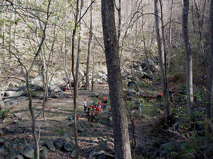
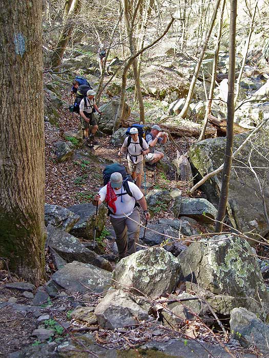